Aurora_Kp_Map_Eurasia.gif
Size of this preview:
800 × 400 pixels
.
Other resolutions:
320 × 160 pixels
|
845 × 422 pixels
.
Summary
| Description |
English:
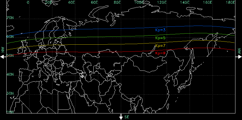
This map shows the midnight equatorward boundary of the aurora phenomena at different levels of geomagnetic activity. A Kp=3 represents very low geomagnetic activity, while a Kp=9 represents a very high level.
|
| Date | |
| Source | http://www.swpc.noaa.gov/Aurora/index.html#kpmaps |
| Author | NOAA National Weather Service Space Environment Center , Boulder, Colorado, USA |
Licensing
|
|
This image is in the
public domain
because it contains materials that originally came from the U.S.
National Oceanic and Atmospheric Administration
, taken or made as part of an employee's official duties.
|
|