Blazed_alder_snotel.jpg
No higher resolution available.
Summary
| Description |
English:
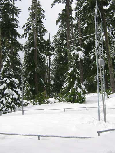
Snow telemetry (SNOTEL) station near
Blazed Alder Creek
in northwest Oregon, United States. At 3,650 feet (1,110 m), the station is the highest above sea level of the three SNOTELs in the
Bull Run River
watershed.
|
| Date | Unknown date but post-1982 |
| Source | Blazed Alder SNOTEL , Natural Resources Conservation Service of the U.S. Department of Agriculture |
| Author | Unknown author |
Licensing
|
|
This image is a work of the Natural Resources Conservation Service , part of the United States Department of Agriculture , taken or made as part of an employee's official duties. As a work of the U.S. federal government , the image is in the public domain in the United States. |
|