Bouvet_Island_topographic_map-en.svg

Size of this PNG preview of this SVG file:
800 × 550 pixels
.
Other resolutions:
320 × 220 pixels
|
640 × 440 pixels
|
1,024 × 704 pixels
|
1,280 × 880 pixels
|
2,560 × 1,761 pixels
|
2,800 × 1,926 pixels
.
Summary
| Camera location |
|
View this and other nearby images on: OpenStreetMap |
|
|---|
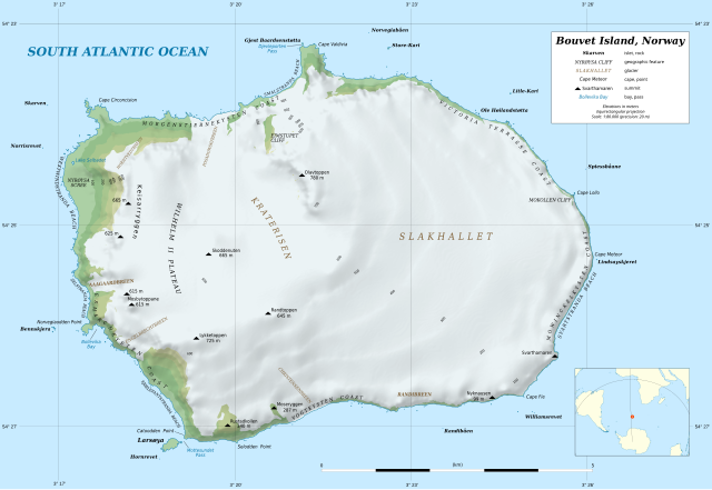
| Description |
Deutsch:
Topografische Karte von
Bouvetinsel
English:
Topographic map in English of
Bouvet Island
Français :
Carte topographique en anglais de l’
île Bouvet
.
Scale: 1:80,000 (precision: 20 m for the topography and ground features)
|
||
| Date | |||
| Source |
data:
|
||
| Author | Eric Gaba ( Sting - fr:Sting ) | ||
|
Permission
( Reusing this file ) |
|
||
| Other versions |
[
]
|


Licensing
I, the copyright holder of this work, hereby publish it under the following license:
This file is licensed under the
Creative Commons
Attribution-Share Alike 4.0 International
license.
-
You are free:
- to share – to copy, distribute and transmit the work
- to remix – to adapt the work
-
Under the following conditions:
- attribution – You must give appropriate credit, provide a link to the license, and indicate if changes were made. You may do so in any reasonable manner, but not in any way that suggests the licensor endorses you or your use.
- share alike – If you remix, transform, or build upon the material, you must distribute your contributions under the same or compatible license as the original.