Cape_Dezhnev_USCGS_1937.PNG
Size of this preview:
800 × 350 pixels
.
Other resolutions:
320 × 140 pixels
|
816 × 357 pixels
.
Summary
| Description |
English:
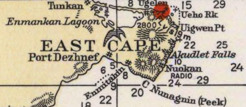
Detail of 1937 USCGS Bering Sea ahowing Cape Dezhnev aka East Cape with geographical features and villages marked.
|
| Date | |
| Source | Historical Maps and Charts Project, Office of Coast Survey, US NOAA Bering Sea Chart 9302 6_1937 http://historicalcharts.noaa.gov/historicals/historical_zoom.asp |
| Author | USCGS |
Licensing
|
|
This image is in the
public domain
because it contains materials that originally came from the U.S.
National Oceanic and Atmospheric Administration
, taken or made as part of an employee's official duties.
|
|