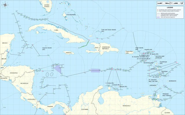
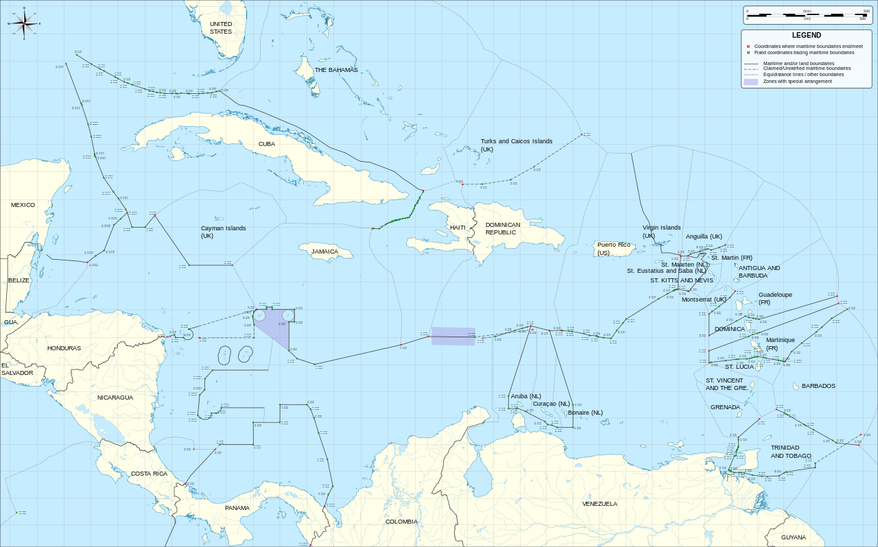
Caribbean_maritime_boundaries_map.svg

Size of this PNG preview of this SVG file:
800 × 499 pixels
.
Other resolutions:
320 × 200 pixels
|
640 × 399 pixels
|
1,024 × 639 pixels
|
1,280 × 798 pixels
|
2,560 × 1,597 pixels
|
3,561 × 2,221 pixels
.
Summary
| Description |
English:
Map of maritime boundaries in the Caribbean Sea and Gulf of Mexico
|
| Date | |
| Source | Mapa del Mar Caribe (límites marinos).svg |
| Author | Milenioscuro , translated by Thayts |
| Other versions |
|
| SVG development |
.svg)
Licensing
This file is licensed under the
Creative Commons
Attribution-Share Alike 3.0 Unported
license.
-
You are free:
- to share – to copy, distribute and transmit the work
- to remix – to adapt the work
-
Under the following conditions:
- attribution – You must give appropriate credit, provide a link to the license, and indicate if changes were made. You may do so in any reasonable manner, but not in any way that suggests the licensor endorses you or your use.
- share alike – If you remix, transform, or build upon the material, you must distribute your contributions under the same or compatible license as the original.
| Annotations | This image is annotated: View the annotations at Commons |