Cypress_structure.jpeg
Size of this preview:
800 × 521 pixels
.
Other resolutions:
320 × 208 pixels
|
640 × 416 pixels
|
1,024 × 666 pixels
|
1,280 × 833 pixels
|
2,560 × 1,666 pixels
|
3,590 × 2,336 pixels
.
Summary
| Description |
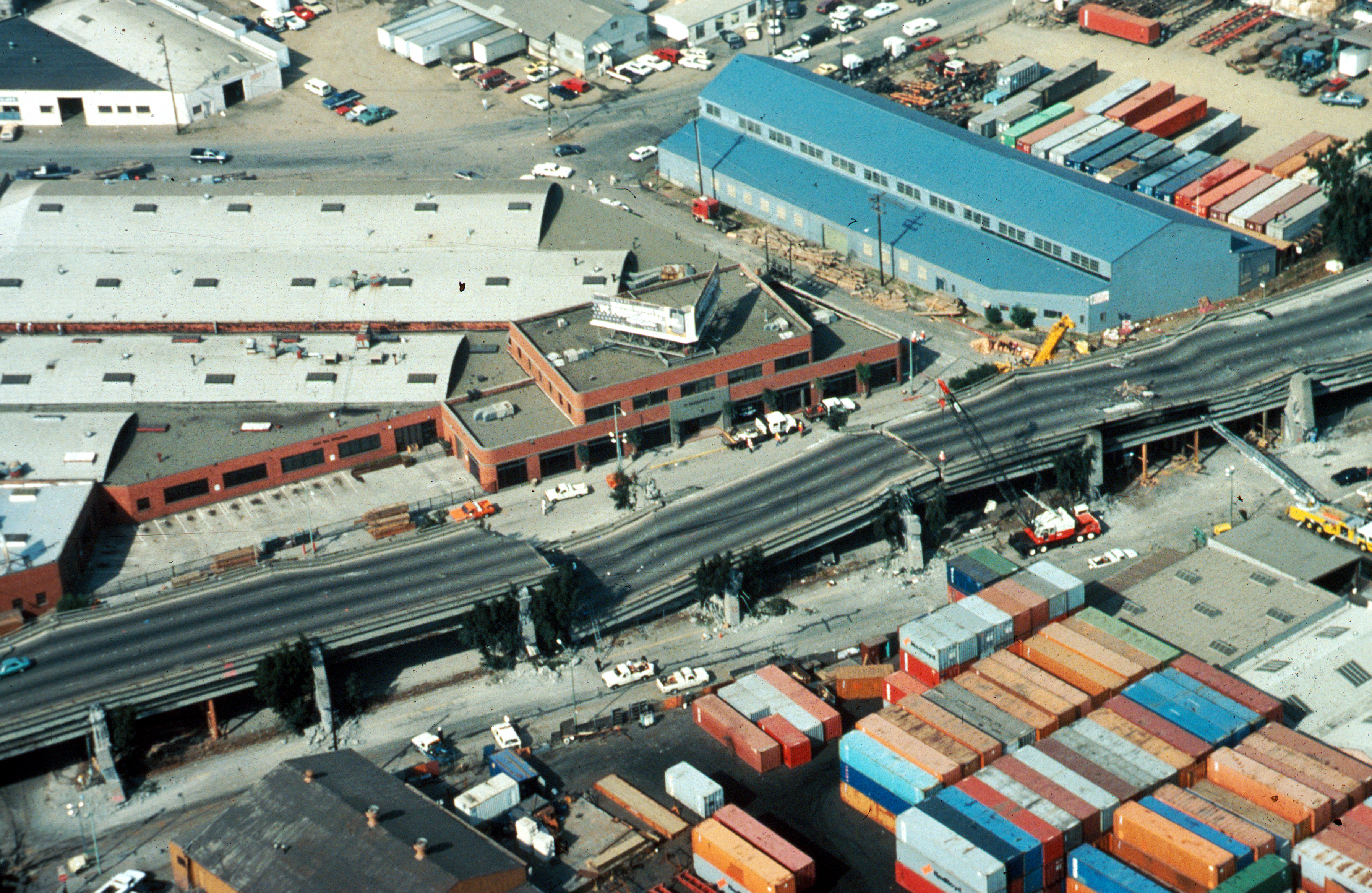
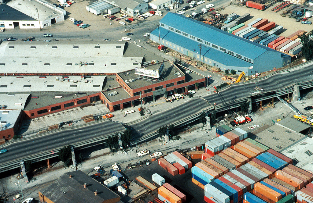
USGS photo from 1989 Loma Prieta earthquake . Caption : Aerial view of collapsed sections of the en:Cypress Viaduct of en:Interstate 880 . [H.G. Wilshire, U.S. Geological Survey] |
| Date | |
| Source |
Photo by H. G. Wilshire for U.S. Geological Survey. High res version on line at : [1] Lower resolution version: Original image here : http://pubs.usgs.gov/dds/dds-29/web_pages/oakland.html |
| Author | H.G. Wilshire, U.S. Geological Survey |
|
Permission
( Reusing this file ) |
PD-USGOV-INTERIOR-USGS. |
| Other versions |
|

Licensing
|
|
This image is in the
public domain
in the United States because it only contains materials that originally came from the
United States Geological Survey
, an agency of the
United States Department of the Interior
. For more information, see
the official USGS copyright policy
.
|
|