Drum-Heller-Channels.jpg
No higher resolution available.
Summary
| Description |
English:
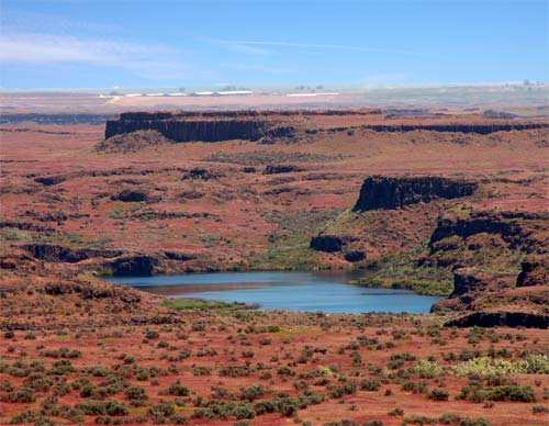
Drumheller Channels; East edge of the Royal Slope in the Columbia Valley south of the Pot Holes Reservoir by 10 miles; the lake I believe is Black Lake.
|
| Date | 16 August 2004 (original upload date) |
| Source | Own work by the original uploader |
| Author | Woofles ( talk · contribs ) |
|
Permission
( Reusing this file ) |
Released under the GNU Free Documentation License . |
Licensing
Woofles
at
English Wikipedia
, the copyright holder of this work, hereby publishes it under the following licenses:

|
Permission is granted to copy, distribute and/or modify this document under the terms of the GNU Free Documentation License , Version 1.2 or any later version published by the Free Software Foundation ; with no Invariant Sections, no Front-Cover Texts, and no Back-Cover Texts. A copy of the license is included in the section entitled GNU Free Documentation License . Subject to disclaimers . |
|
|
This file is licensed under the Creative Commons Attribution-Share Alike 3.0 Unported license. Subject to disclaimers . | |
| Attribution: Woofles at English Wikipedia | ||
|
||
| This licensing tag was added to this file as part of the GFDL licensing update . |
You may select the license of your choice.
Original upload log
Transferred from en.wikipedia to Commons by Hike395 .
The original description page was
here
. All following user names refer to en.wikipedia.
- 2004-08-16 20:30 Woofles 500×388×8 (38205 bytes) DrumHeller Channels