Early_Localization_Native_Americans_USA.jpg
Size of this preview:
800 × 514 pixels
.
Other resolutions:
320 × 206 pixels
|
640 × 412 pixels
|
1,024 × 659 pixels
|
1,280 × 823 pixels
|
2,560 × 1,646 pixels
|
3,850 × 2,476 pixels
.
Summary
| Description |
English:
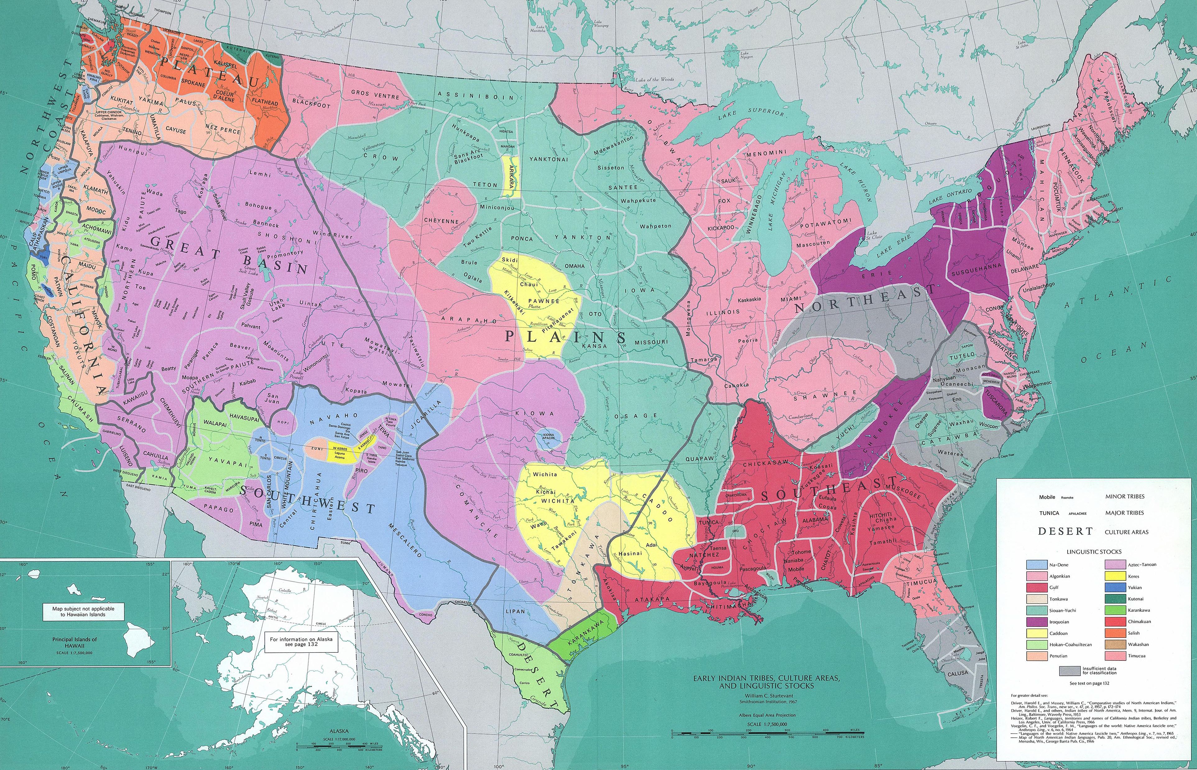
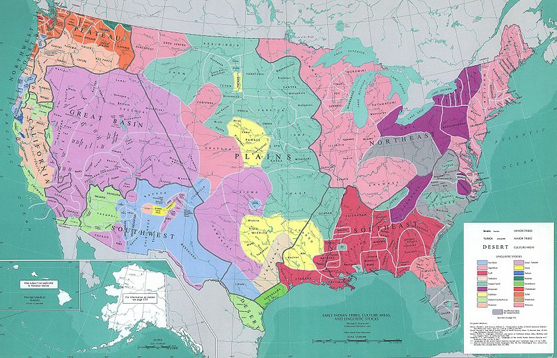
Map reconstituting the geographic culture areas of the early Native American tribes and the different Amerindian languages that were spoken in the USA.
Español:
Mapa que reconstituye de forma geográfica las zonas culturales de las primeras tribus indígenas de los Estados Unidos y los varios idiomas ameríndios que se hablaban en ese país
Português:
Mapa reconstituindo as áreas geográficas da cultura das primeiras tribos indígenas americanas e as diferentes línguas ameríndias faladas nos Estados Unidos.
|
|||
| Date | ||||
| Source | 1967 USGS map. | |||
| Author | William C. Sturtevant, Smithsonian Institute, 1967 | |||
|
Permission
( Reusing this file ) |
|
|||
| Other versions |
Derivative works of this file: Early Localization Native Americans NY.jpg Early Indian Languages USA.jpg Derivative works of this file: Early Localization Native Americans USA-nw.png Early Indian Languages of the USA (NW) |