Edfu_Tempel_42.jpg
Size of this preview:
440 × 599 pixels
.
Other resolutions:
176 × 240 pixels
|
352 × 480 pixels
|
564 × 768 pixels
|
752 × 1,024 pixels
|
1,784 × 2,430 pixels
.
| Description |
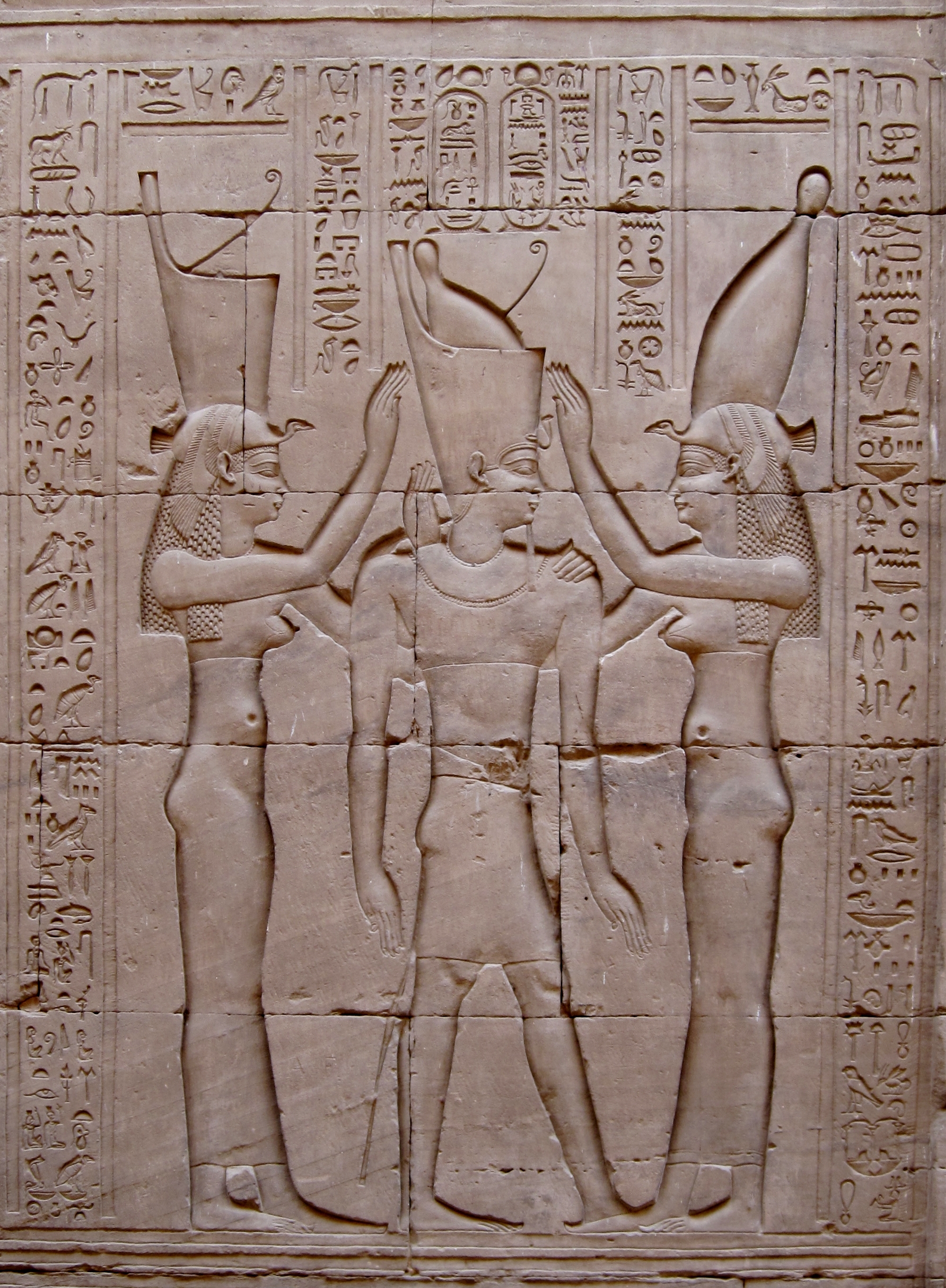
Deutsch:
Pharao
Ptolemaios VIII.
, zwischen den Göttinnen
Wadjet
von Unterägypten (links) und
Nechbet
von Oberägypten (rechts), Wandrelief im Tempel von Edfu, Ägypten
English:
Pharoah Ptolemy VIII between the goddesses Wadjet (symbolizing upper egypt) and Nekhbet (symbolizing lower Egypt). Bas-relief on wall of Temple of Edfu, Egypt
Français :
Le Pharaon
Ptolémée VIII
(Jwˁ-nṯr.wy-pr.wy Stp-n-Ptḥ Jr-mȝˁ.t-Rˁ Sḫm-ˁnḫ-Jmn), entre les déesses
Ouadjet
symbolisant la Basse-Egypte (à gauche), et
Nekhbet
symbolisant la Haute-Egypte (à droite). Bas-relief mural dans le Temple d'Edfou, Egypte
|
||
| Date | |||
| Source | Own work | ||
| Author | Olaf Tausch | ||
|
Permission
( Reusing this file ) |
I, the copyright holder of this work, hereby publish it under the following licenses:
This file is licensed under the
Creative Commons
Attribution 3.0 Unported
license.
You may select the license of your choice.
|
||
| Other versions | Derivative works of this file: Edfu Tempel 42 Entzerrversuch.jpg |

| Camera location |
|
View this and other nearby images on: OpenStreetMap |
|
|---|
|
|
This image has been assessed using the
Quality image guidelines
and is considered a
Quality image
.
|