Estados_República_Federal_Española_1873.jpg

Size of this preview:
800 × 539 pixels
.
Other resolutions:
320 × 216 pixels
|
640 × 431 pixels
|
1,024 × 690 pixels
|
1,366 × 920 pixels
.
Summary
| Description |
Español:
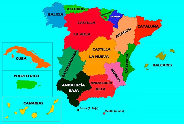
Estados de la Nación Española propuestos en el proyecto de Constitución Federal de 1873. Nótese que el mapa no refleja la I República en su conjunto, la cual incluía además la Capitanía General de Filipinas y ciertos territorios en África. Sólo se muestran las regiones que, de haber entrado en vigor la Carta Magna, se hubiesen constituido como Estados federados de pleno derecho.
|
| Date | |
| Source | Own work |
| Author | DavidGM153 |
Licensing
I, the copyright holder of this work, hereby publish it under the following license:
This file is licensed under the
Creative Commons
Attribution-Share Alike 4.0 International
license.
-
You are free:
- to share – to copy, distribute and transmit the work
- to remix – to adapt the work
-
Under the following conditions:
- attribution – You must give appropriate credit, provide a link to the license, and indicate if changes were made. You may do so in any reasonable manner, but not in any way that suggests the licensor endorses you or your use.
- share alike – If you remix, transform, or build upon the material, you must distribute your contributions under the same or compatible license as the original.