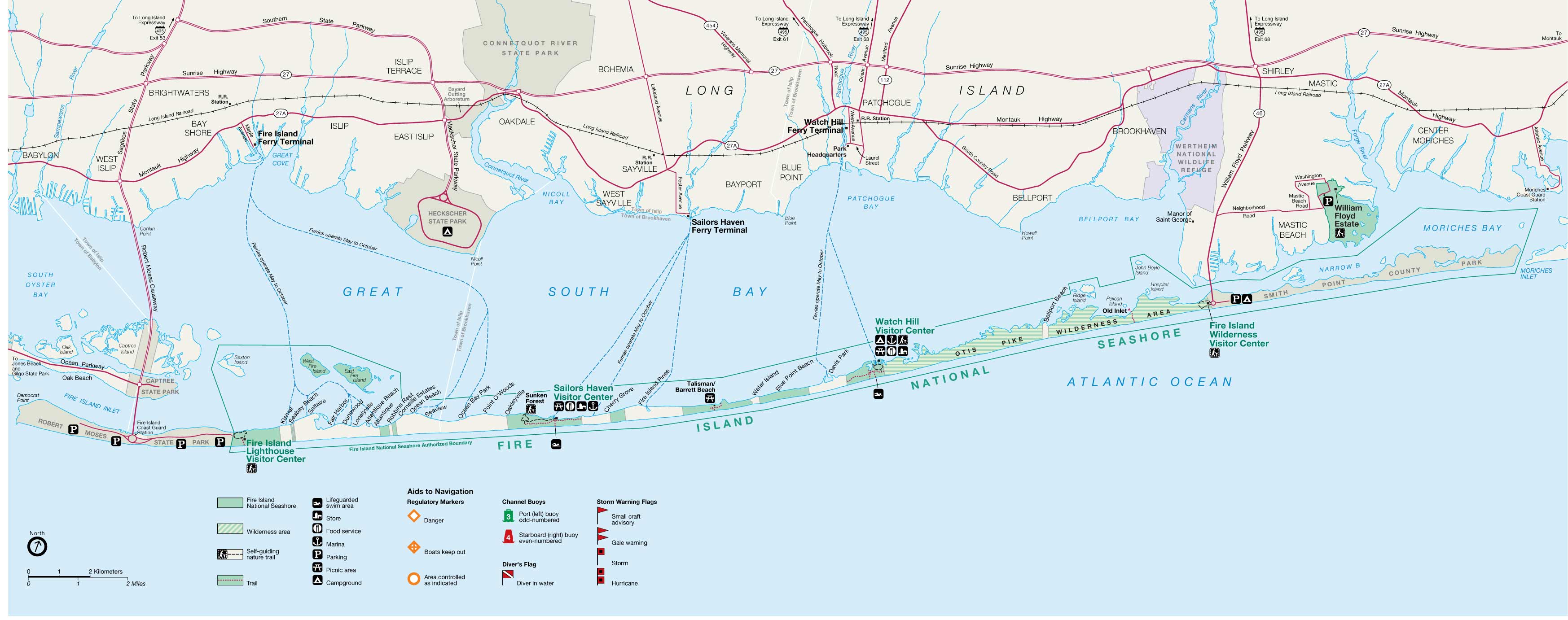
Fire-island-map.jpg
Size of this preview:
800 × 317 pixels
.
Other resolutions:
320 × 127 pixels
|
640 × 253 pixels
|
1,024 × 405 pixels
|
1,280 × 506 pixels
|
3,493 × 1,382 pixels
.
Summary
| Description |
English:
Fire Island
map from USGS
|
||
| Source | http://ny.cf.er.usgs.gov/nyprojectsearch/projects/2457-BUF-1.html | ||
| Creator |
United States Geological Survey / Fire Island Inlet National Park
|
||
| Georeferencing | If inappropriate please set warp_status = skip to hide. | ||
| Other versions |
|


Licensing
|
|
This image is in the
public domain
in the United States because it only contains materials that originally came from the
United States Geological Survey
, an agency of the
United States Department of the Interior
. For more information, see
the official USGS copyright policy
.
|
|
Original upload log
Transferred from en.wikipedia to Commons by Vmenkov using CommonsHelper .
The original description page was
here
. All following user names refer to en.wikipedia.
- 2007-11-21 10:21 Americasroof 3493×1382× (371827 bytes) [[Fire Island, New York]] map from USGS http://ny.cf.er.usgs.gov/nyprojectsearch/projects/projectImages/2457-BUF-1_image002.jpg