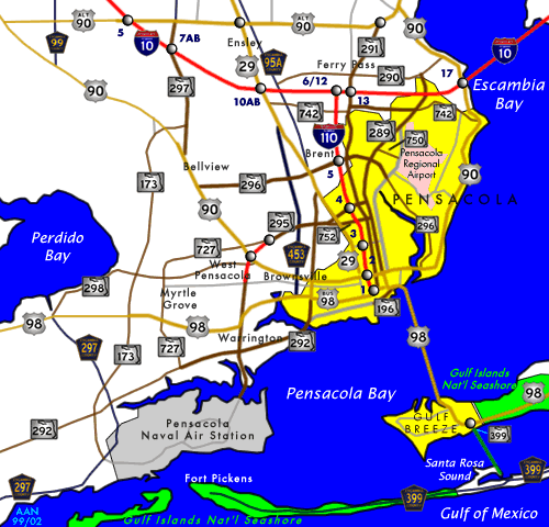
Florida-Pensacola-map-legend-X-6-1756-FAA.gif
No higher resolution available.
Summary
| Description |
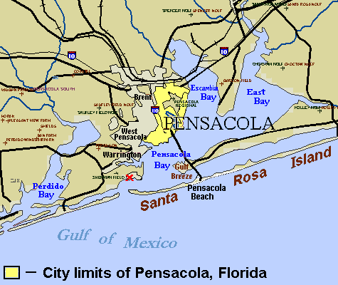
English:
City map of
Pensacola
, with city limits marked by legend (
see
References
maps
). The site of the
first settlement
near Pensacola (
Ochuse
) is marked by the red "X" near the site of
Fort Barrancas
. Small crosses designate airfields in the region. Areas have been labeled for the communities of
Brent
,
West Pensacola
,
Warrington
,
Gulf Breeze
, and
Pensacola Beach
. (Several other towns have not been labeled.)
|
| Source |
( Original text: Source URL ( U.S. Government FAA ): http://tfr.faa.gov/save_maps/map_6_1756.gif (Airfield map trimmed/edited to set Pensacola city limits, label "Santa Rosa Island" (below site marked "X") plus Interstate-10/110 icons, "Pensacola Bay" and other bays). The file is in GIF format, which can be edited in detail without loss of colors. References
|
| Author |
Licensing
|
|
This image or file is a work of a
Federal Aviation Administration
employee, taken or made as part of that person's official duties. As a
work
of the
U.S. federal government
, the image is in the
public domain
in the United States.
|

|
Original upload log
The original description page was
here
. All following user names refer to en.wikipedia.
| Date/Time | Dimensions | User | Comment |
|---|---|---|---|
| 2007-07-31 16:42 | 475×400× (16590 bytes) | Wikid77 | Map width cropped 21% to enlarge labels 21%. Added "Pensacola Beach" & enlarged "Warrington" with I-10 icons. |
| 2007-07-29 13:41 | 600×455× (19615 bytes) | Wikid77 | Reduced Pensacola city limits (see reference maps), icons I-10/110, labeled [[Brent, FL|Brent]], [[Warrington, FL|Warrington]], "[[West Pensacola, FL|West Pensacola]]" & Gulf Breeze. |
| 2007-01-12 04:25 | 600×455× (18935 bytes) | Wikid77 | City map of [[Pensacola, Florida]], with city limits marked by legend. The site of the [[History of Pensacola, Florida|first settlement]] of Pensacola (''Ochuse'') is marked by the red "X" at the site of [[Fort Barrancas]]. Small crosses designate airfie |
| 2007-01-11 20:23 | 600×470× (18863 bytes) | Wikid77 | City map of [[Pensacola, Florida]], with city limits marked by legend. The site of the [[History of Pensacola, Florida|first settlement]] of Pensacola (''Ochuse'') is marked by the red "X" at the site of [[Fort Barrancas]]. Small crosses designate airfie |