Fragmentation_of_the_Abbasid_Caliphate.jpg

Size of this preview:
800 × 538 pixels
.
Other resolutions:
320 × 215 pixels
|
640 × 430 pixels
|
1,024 × 688 pixels
|
1,344 × 903 pixels
.
| Description |
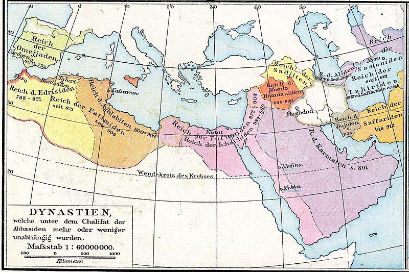
Deutsch:
Das Reich der Kalifen bis 945. Karte aus dem Historischen Handatlas von Gustav Droysen, 1886
|
| Date | (UTC) |
| Source | |
| Author |
|
| Other versions | العربيَّة |
|
|
This is a
retouched picture
, which means that it has been digitally altered from its original version. The original can be viewed here:
Arabische Eroberung 2.jpg
:
|
|
|
This work is in the public domain in its country of origin and other countries and areas where the copyright term is the author's life plus 100 years or fewer . This work is in the public domain in the United States because it was published (or registered with the U.S. Copyright Office ) before January 1, 1929. |
| This file has been identified as being free of known restrictions under copyright law, including all related and neighboring rights. | |
Original upload log
This image is a derivative work of the following images:
-
File:Arabische_Eroberung_2.jpg
licensed with PD-old
- 2007-02-24T00:51:40Z Nikephoros 2187x1389 (772419 Bytes) {{Information |Description=Karte des Kalifates vom Tode Mohammeds bis 945 |Source=Professor G. Droysens Allgemeiner Historischer Handatlas |Date=1886 |Author=G. Droysen |Permission=not necessary |other_versions= }}
Uploaded with derivativeFX