Franco-Cantabrian_region.gif

Size of this preview:
800 × 403 pixels
.
Other resolutions:
320 × 161 pixels
|
640 × 323 pixels
|
956 × 482 pixels
.
Summary
| Description |
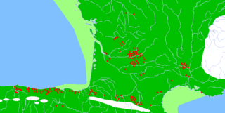
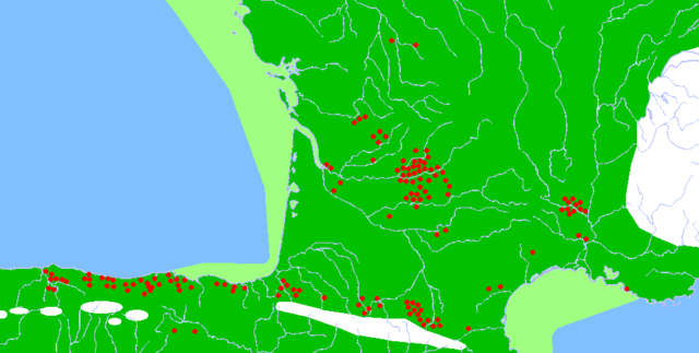
Description: Map of the Franco-Cantabrian archaeological region (Upper Paleolithic), showing:
|
| Date | |
| Source |
|
| Author |
|
|
Permission
( Reusing this file ) |
Released into the public domain (by the author). |
| Other versions | Derivative works of this file: Franco-Cantabrian region Altamira.gif |
Licensing
|
|
This work has been released into the
public domain
by its author,
Sugaar
, at the
English Wikipedia
project
. This applies worldwide.
In case this is not legally possible:
|
| Annotations | This image is annotated: View the annotations at Commons |