Galapagos-satellite-esislandnames.jpg
No higher resolution available.
Summary
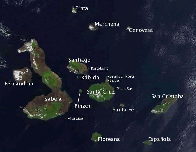
| Description | Satellite photo of the Galapagos islands overlayed with the Spanish names of the visible main islands. | ||||||||||
| Source | Based on the public domain NASA satellite photo Image:Galapagos-satellite-2002.jpg . Island names on labels are from the Wikipedia article w:en:Galápagos Islands and placed to the best of the author's knowledge. | ||||||||||
| Author | labeled by Storpilot | ||||||||||
|
Permission
( Reusing this file ) |
|
||||||||||
| Other versions |

|

Licensing
|
|
I, the copyright holder of this work, release this work into the
public domain
. This applies worldwide.
In some countries this may not be legally possible; if so: I grant anyone the right to use this work for any purpose , without any conditions, unless such conditions are required by law. |