Giant's_Causeway_(14).JPG
Size of this preview:
800 × 530 pixels
.
Other resolutions:
320 × 212 pixels
|
640 × 424 pixels
|
1,024 × 678 pixels
|
1,280 × 848 pixels
|
2,560 × 1,695 pixels
|
3,840 × 2,543 pixels
.
Summary
| Description |
Čeština:
Obrův chodník, anglicky
Giant’s Causeway
, Severní Irsko. Hexagonální odlučnost bazaltů.
English:
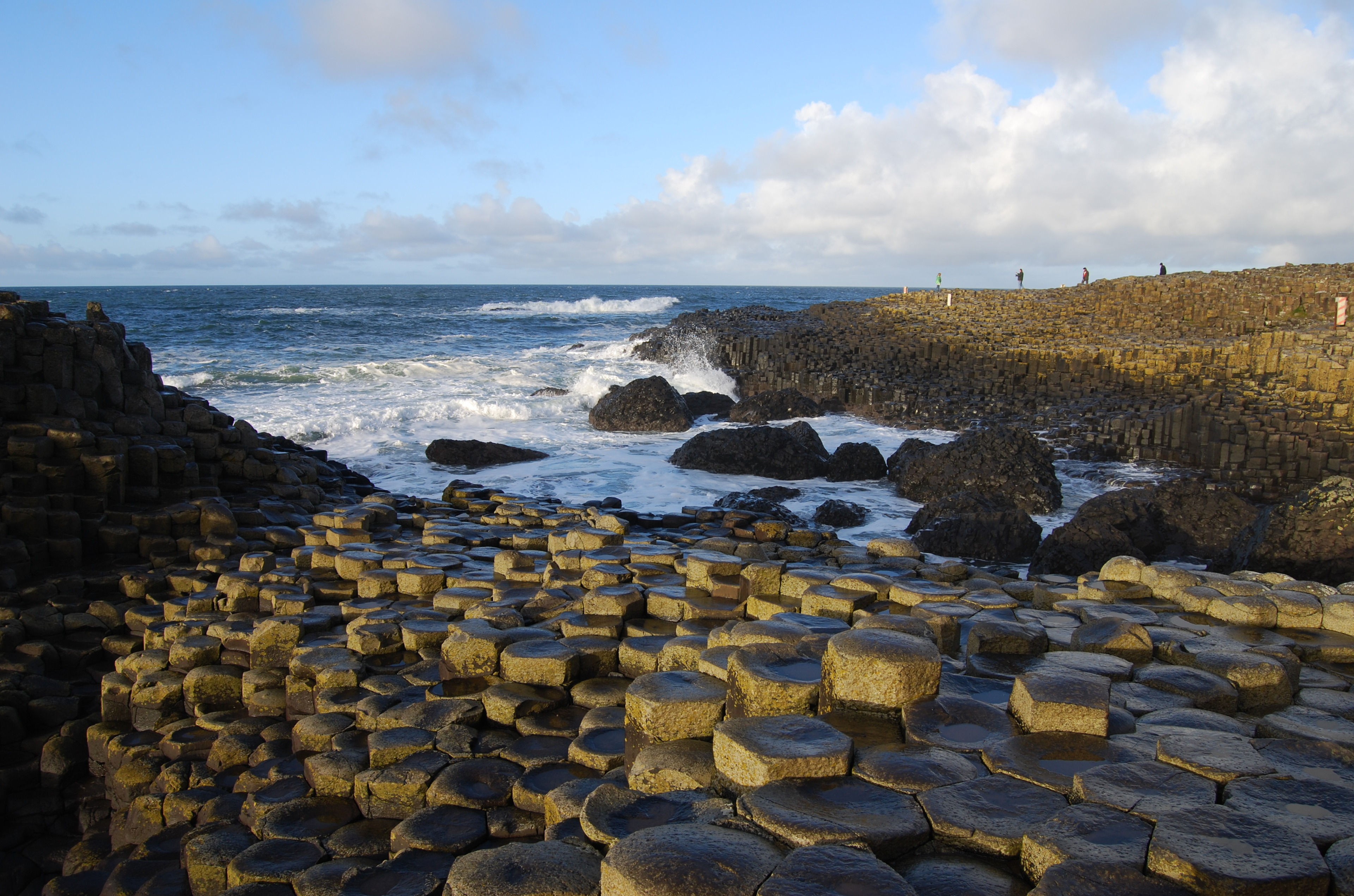
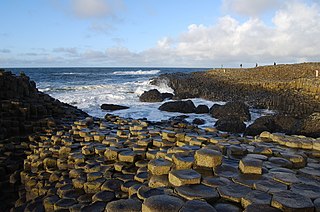
Giant’s Causeway
, Northern Ireland. Hexagonal basalts.
|
| Date | |
| Source |
Own work
This file was uploaded with
Commonist
.
|
| Author | Chmee2 |
| Camera location |
|
View this and other nearby images on: OpenStreetMap |
|
|---|
Assessment
|


.JPG¶ms=055.240458_N_-006.512228_E_globe:Earth_type:camera_type:landmark_region:GB_heading:0.00&language=en)
.JPG)
.JPG)
.JPG)
|
|
This image was selected as
picture of the day
on Wikimedia Commons for
16 December 2010
. It was captioned as follows:
English:
Hexagonal basalts forming
Giant's Causeway
, Northern Ireland.
Other languages:
Čeština
:
Hexagonální odlučnost
bazaltů
tvořících
Giant’s Causeway
(„Obrův chodník“) v
Severním Irsku
English
:
Hexagonal basalts forming
Giant's Causeway
, Northern Ireland.
Íslenska
:
Sexhyrnd basaltlög sem eru hluti af verndunarsvæðinu Giant Causeway, Norður Írlandi.
Nederlands
:
Hexagonale
basaltblokken
in
Noord-Ierland
, die gezamenlijk de rotsformatie
Giant's Causeway
vormen.
Македонски
:
Шестоаголни базалти во
Северна Ирска
.
|
|
|
This image has been assessed using the
Quality image guidelines
and is considered a
Quality image
.
|
Licensing
I, the copyright holder of this work, hereby publish it under the following licenses:

|
Permission is granted to copy, distribute and/or modify this document under the terms of the GNU Free Documentation License , Version 1.2 or any later version published by the Free Software Foundation ; with no Invariant Sections, no Front-Cover Texts, and no Back-Cover Texts. A copy of the license is included in the section entitled GNU Free Documentation License . |
This file is licensed under the
Creative Commons
Attribution 3.0 Unported
license.
-
You are free:
- to share – to copy, distribute and transmit the work
- to remix – to adapt the work
-
Under the following conditions:
- attribution – You must give appropriate credit, provide a link to the license, and indicate if changes were made. You may do so in any reasonable manner, but not in any way that suggests the licensor endorses you or your use.
You may select the license of your choice.