Gleisplan_Frankfurt_Flughafen_SFS.svg

Size of this PNG preview of this SVG file:
625 × 385 pixels
.
Other resolutions:
320 × 197 pixels
|
640 × 394 pixels
|
1,024 × 631 pixels
|
1,280 × 788 pixels
|
2,560 × 1,577 pixels
.
Summary
| Description |
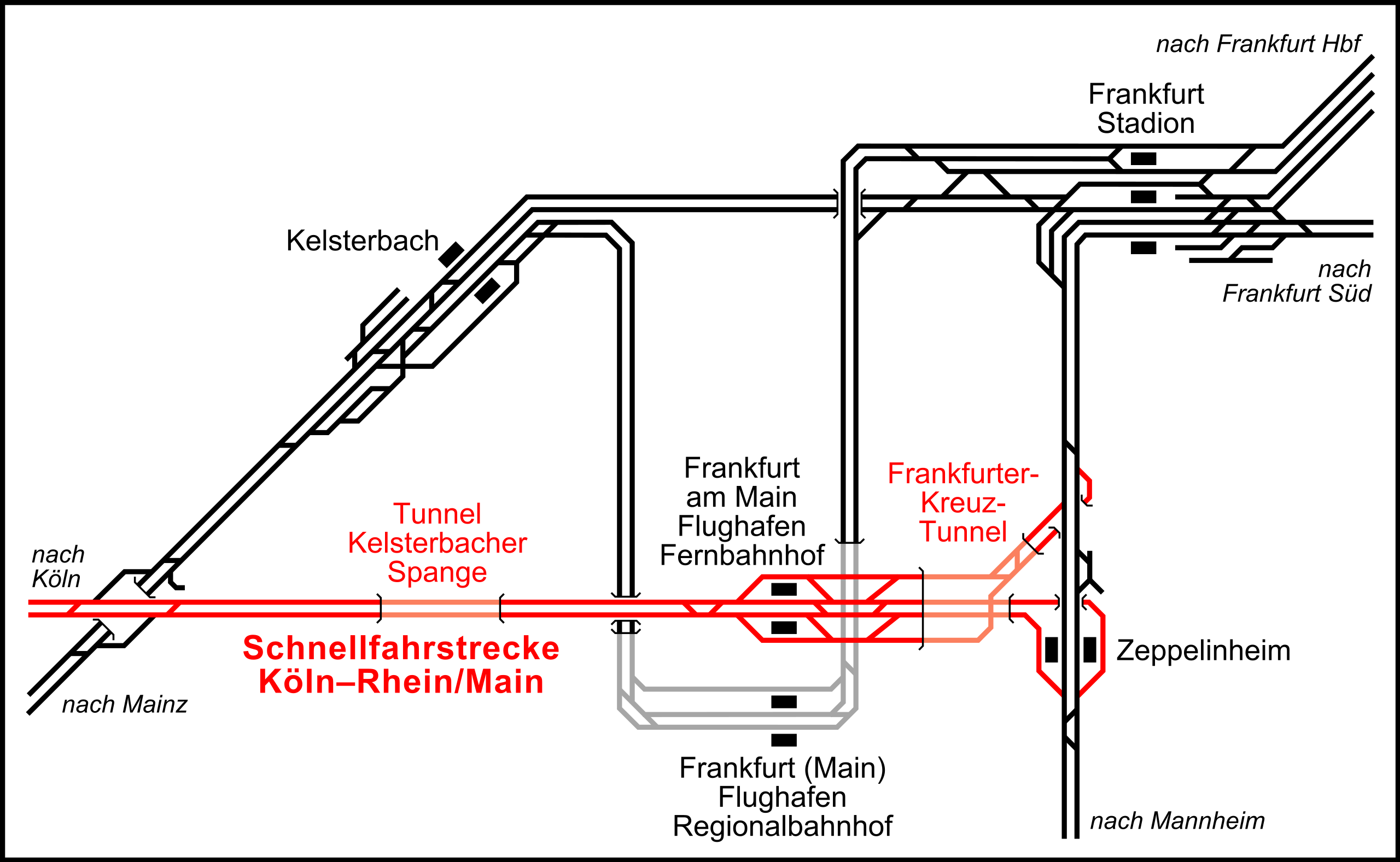
Deutsch:
Gleisanlagen von
Frankfurt (Main) Flughafen Regionalbahnhof
und
Frankfurt (Main) Flughafen Fernbahnhof
sowie deren Einbindung in das Netz der DB, in Rot die
Schnellfahrstrecke Köln–Rhein/Main
.
English:
Railway infrastructure at Frankfurt Airport:
Cologne–Frankfurt high-speed rail line
in red with the long-distance train station (Fernbahnhof); below: Frankfurt Airport regional train station.
Русский:
Железнодорожная инфраструктура в аэропорту Франкфурта: красным цветом показана скоростная линия Кёльн— Франкфурт и вокзал для поездов дальнего следования; ниже находится вокзал для пригородных поездов.
|
||||||||
| Date | |||||||||
| Source | Re-drawing Frankfurt (Main) - Gleisplan Flughafenbahnhof.jpg by Matthias Hintzen, München (Germany) | ||||||||
| Creator | |||||||||
|
Permission
( Reusing this file ) |
|
||||||||
| Georeferencing | If inappropriate please set warp_status = skip to hide. | ||||||||
| Other versions |
|

_-_Gleisplan_Flughafenbahnhof.jpg)


|
This map has been made or improved in the German
Kartenwerkstatt
(Map Lab)
. You can
propose maps
to improve as well.
|