Global_View_of_the_Arctic_and_Antarctic.jpg

Size of this preview:
600 × 600 pixels
.
Other resolutions:
240 × 240 pixels
|
480 × 480 pixels
|
768 × 768 pixels
|
1,024 × 1,024 pixels
|
2,048 × 2,048 pixels
|
8,400 × 8,400 pixels
.
Snapped up crying baby 👶
Summary
| Warning | The original file is very high-resolution. It might not load properly or could cause your browser to freeze when opened at full size. |
|---|
| Description |
English:
Collection:
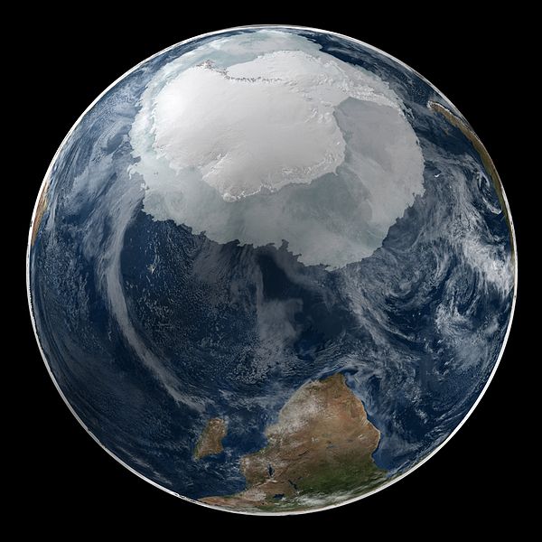
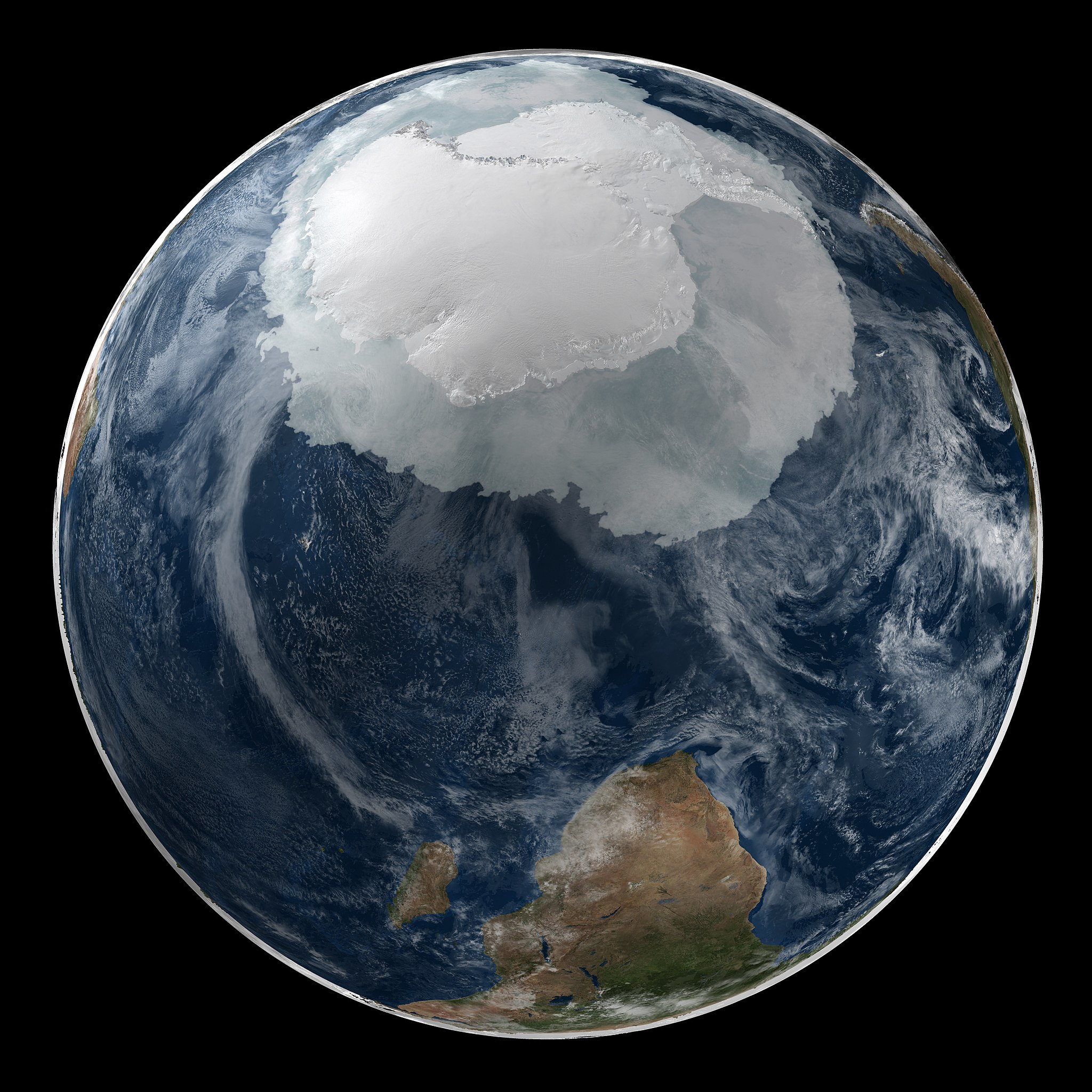
NASA Scientific Visualization Studio Collection.Compilation of NASA stills, film and video, created in partnership with Internet Archive.Image n.a003402. This image shows a view of the Earth on September 21, 2005 with the full Antarctic region visible.
Description:
This matching pair of images showing a global view of the Arctic and Antarctic . The images also show the sea ice in the date at which it was at its minimum extent in the northern hemisphere.
|
| Date | UTC |
| Source | Global View of the Arctic and Antarctic on September 21, 2005 |
| Author | NASA on The Commons |
| Other versions | Derivative works of this file: Antarktyda i Antarktyka.jpg |
Licensing
|
This image was taken from
Flickr
's
The Commons
. The uploading organization may have various reasons for determining that
no known copyright restrictions
exist, such as:
More information can be found at https://flickr.com/commons/usage/ . Please add additional copyright tags to this image if more specific information about copyright status can be determined. See Commons:Licensing for more information. |
|
|
This image, originally posted to Flickr , was reviewed on 14 October 2010 by the administrator or reviewer Truu , who confirmed that it was available on Flickr under the stated license on that date. |
File information
- Title #: Global View of the Arctic and Antarctic on September 21, 2005
- Instrument #: Terra/MODIS
- Instrument #: Aqua/AMSR-E
- Completed #: 2007-02-08
- Credit #: Credit for this visualization to NASA/Goddard Space Flight Center Scientific Visualization Studio The Blue Marble data is courtesy of Reto Stockli (NASA/GSFC).
- Studio #: SVS
- Animator #: Cindy Starr (Lead)
- Scientist #: Ronald Weaver (University of Colorado)
- Data Collected : AMSR-E Sea Ice: 2005-09-21; Blue Marble cloud layer 2002; Blue Marble Next Generation Seasonal Landcover 2004-09
- UID : SPD-SCIVS- http://svs .gsfc.nasa.gov/vis/a 000000/a003400/a0034 02/NSIDCimages__SPcl *ouds.2158-IMAGE
- Original url : svs.gsfc.nasa.gov/vis/a000000/a003400/a003402/index.html
- SOURCE #: nasaimages.org/luna/servlet/detail/NSVS~3~3~7128~107128
- URL's visited #:
-
- www.nasaimages.org for the most comprehensive compilation of NASA stills, film and video, created in partnership with Internet Archive.'
|
|
This image is in the
public domain
because it is a screenshot from
NASA
’s globe software
World Wind
using a public domain layer, such as Blue Marble, MODIS, Landsat, SRTM, USGS or GLOBE.
|

|