Great_Tenmei_Famine_Map_Artwork.png
Size of this preview:
429 × 599 pixels
.
Other resolutions:
172 × 240 pixels
|
344 × 480 pixels
|
797 × 1,113 pixels
.
Summary
| Description |
English:
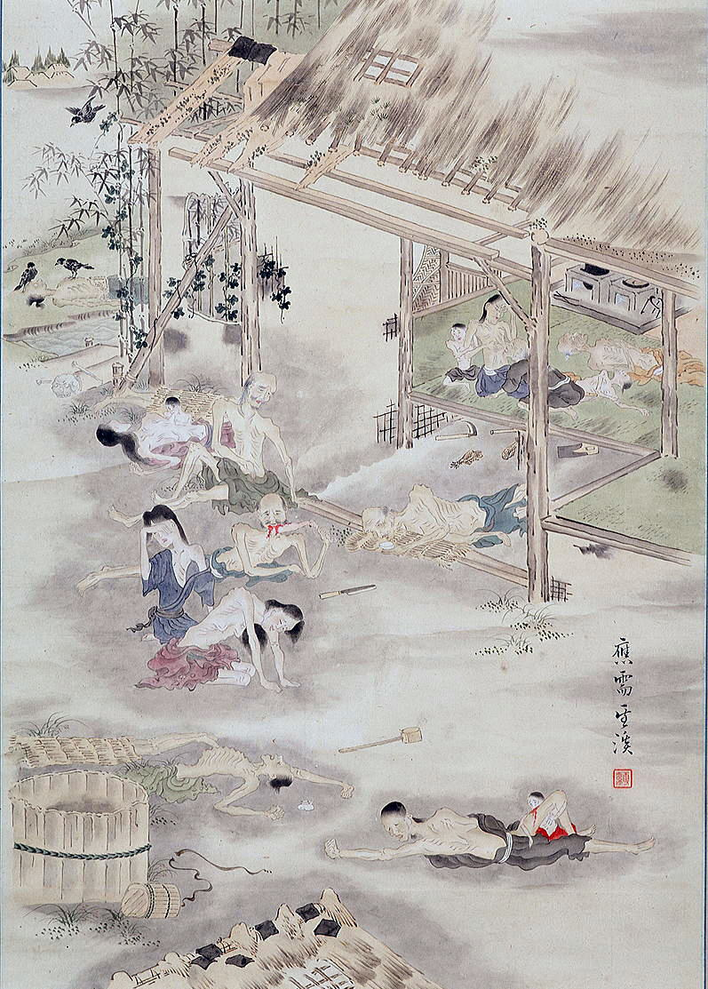
The Great Tenmei Famine Map artwork (circa 1786). The famine was from 1782 until 1788 caused by the 1783 eruption of Mount Asama as well as the Icelandic Laki eruption of 1783 and largely by mismanagement of the Shogunate. It was the deadliest of 4 great famines in the Edo period.
日本語:
天明飢饉之図『福島県会津美里町教育委員会所蔵』
|
| Date | Circa 1786 |
| Source | Fukushima Prefecture Aizumisato Town Board of Education Collection - https://web.archive.org/web/20210513041539/http://historia.justhpbs.jp/aizutenmei.html |
| Author | Unknown |
Licensing
|
This is a faithful photographic reproduction of a two-dimensional,
public domain
work of art. The work of art itself is in the public domain for the following reason:
The official position taken by the Wikimedia Foundation is that "
faithful reproductions of two-dimensional public domain works of art are public domain
".
This photographic reproduction is therefore also considered to be in the public domain in the United States. In other jurisdictions, re-use of this content may be restricted; see Reuse of PD-Art photographs for details. |
||||