Griechischen_und_phönizischen_Kolonien.jpg
Size of this preview:
800 × 456 pixels
.
Other resolutions:
320 × 182 pixels
|
640 × 365 pixels
|
1,024 × 583 pixels
|
1,280 × 729 pixels
|
2,836 × 1,616 pixels
.
Summary
| Description |
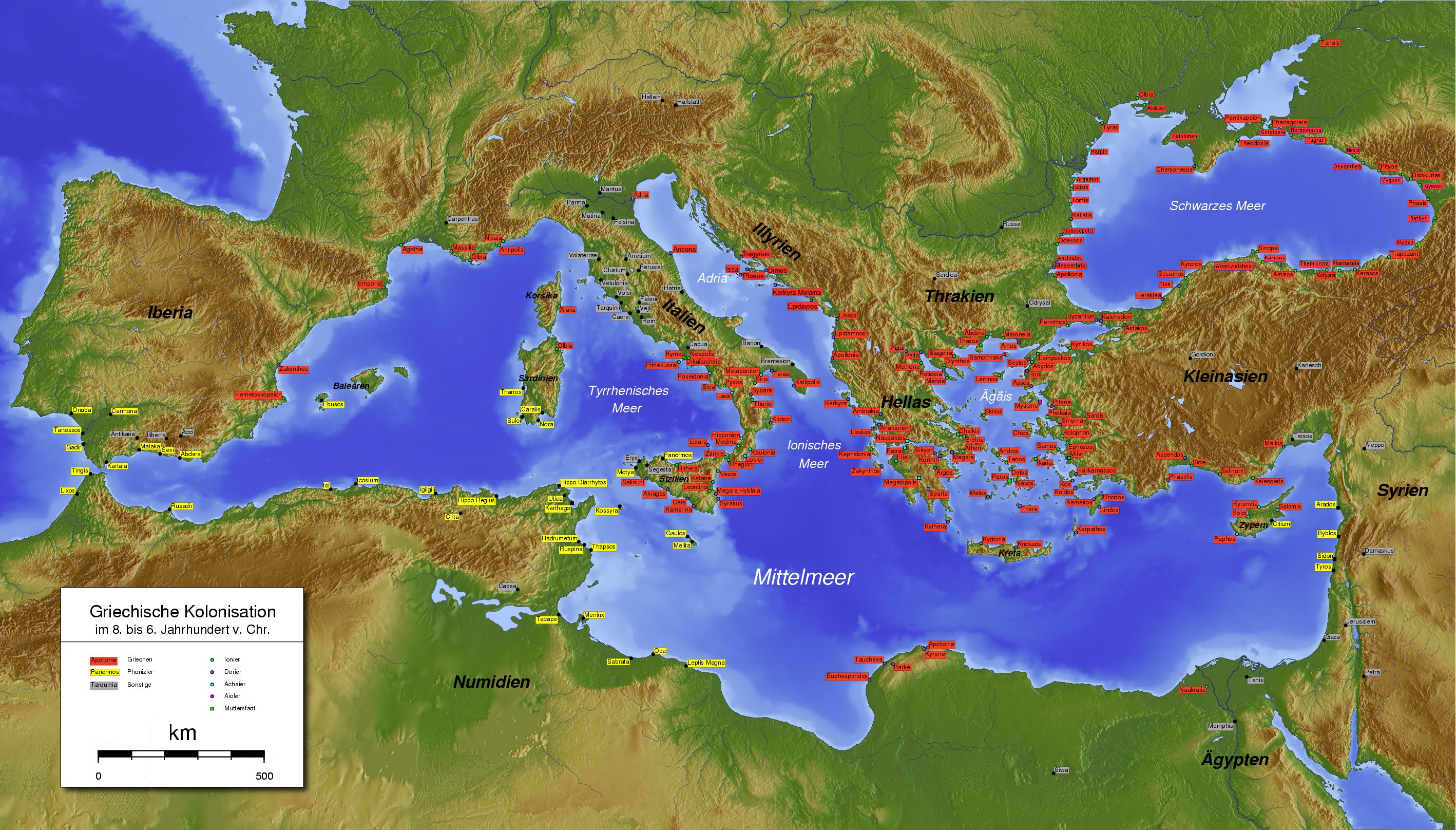
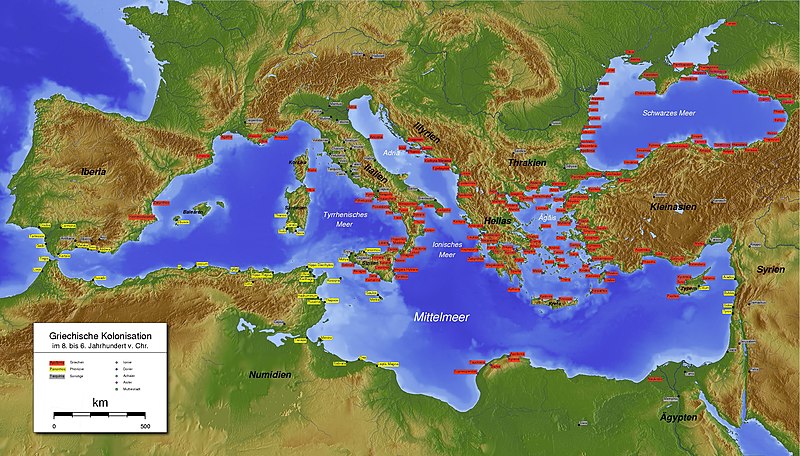
Español:
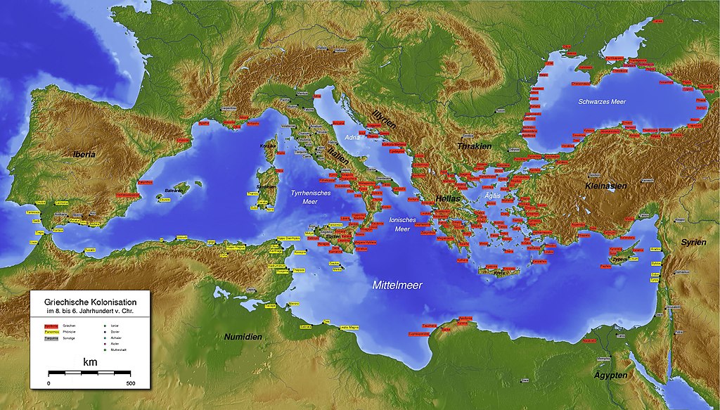
Mapa completo de las colonias griegas y púnicas en el siglo IV a. C. en la cuenca de mediterráneo.
Italiano:
La carta completa quella analoga, già presente in Commons, aggiungendo le colonie greche dell'Adriatico, che non erano presenti. La situazione rappresentata è quella del IV secolo a.C.
Deutsch:
Aktualisieren. Griechischen und phönizischen Kolonien im vierten Jahrhundert v. Chr.
Ελληνικά:
Υπόμνημα: ελληνικές και φοινικικές αποικίες στον τέταρτο αιώνα π.Χ.
English:
Greek and Phoenician colonies in the fourth century BC. The map from which it was drawn illustrates the situation in previous centuries.
|
| Date | |
| Source | Own work |
| Author | Gepgepgep |
Licensing
I, the copyright holder of this work, hereby publish it under the following license:
This file is licensed under the
Creative Commons
Attribution-Share Alike 3.0 Unported
license.
-
You are free:
- to share – to copy, distribute and transmit the work
- to remix – to adapt the work
-
Under the following conditions:
- attribution – You must give appropriate credit, provide a link to the license, and indicate if changes were made. You may do so in any reasonable manner, but not in any way that suggests the licensor endorses you or your use.
- share alike – If you remix, transform, or build upon the material, you must distribute your contributions under the same or compatible license as the original.