Guinea_map_1725.jpg

Size of this preview:
800 × 449 pixels
.
Other resolutions:
320 × 179 pixels
|
640 × 359 pixels
|
997 × 559 pixels
.
Summary
| Description |
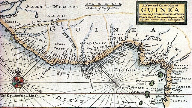
English:
Historic map of the coast of West Africa, then called "Guinea", c. 1725 by
Herman Moll
(1654? – 22 September 1732), a London cartographer, engraver, and publisher.
Nederlands:
Historische kaart van de kust van West-Afrika, destijds "Guinee" genoemd, ong. 1725, door
Herman Moll
. (1654? - 22 september 1732), een Londense cartograaf, graveur en uitgever.
Deutsch:
Historische Karte der Küste Westafrikas, damals "Guinea" genannt, ca. 1725, von
Herman Moll
. (1654? - 22. September 1732), ein Londoner Kartograph, Kupferstecher und Verleger.
|
| Source | http://pirateshold.buccaneersoft.com/images/maps/guinea-map.jpg and other sources |
| Author | Herman Moll |
Licensing
|
This is a faithful photographic reproduction of a two-dimensional,
public domain
work of art. The work of art itself is in the public domain for the following reason:
The official position taken by the Wikimedia Foundation is that "
faithful reproductions of two-dimensional public domain works of art are public domain
".
This photographic reproduction is therefore also considered to be in the public domain in the United States. In other jurisdictions, re-use of this content may be restricted; see Reuse of PD-Art photographs for details. |
||||