Haiti_deforestation.jpg
Size of this preview:
800 × 600 pixels
.
Other resolutions:
320 × 240 pixels
|
640 × 480 pixels
|
1,024 × 768 pixels
|
1,280 × 960 pixels
|
2,560 × 1,920 pixels
.
| Description |
English:
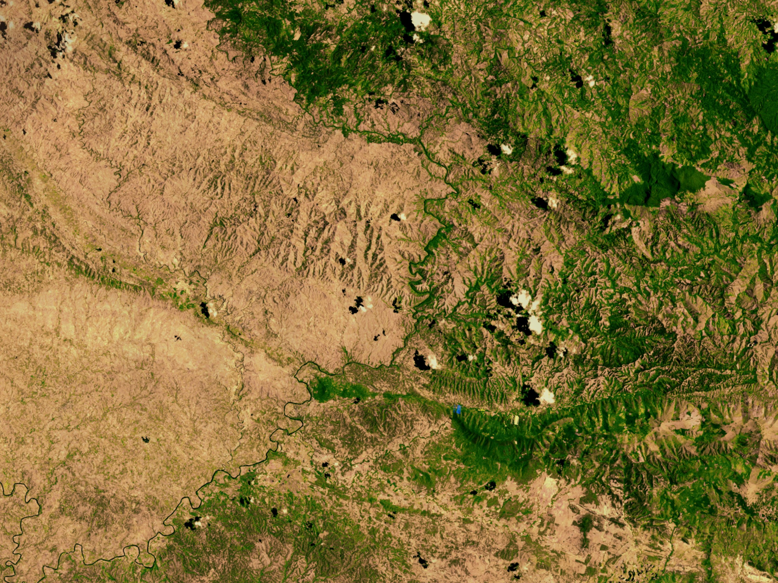
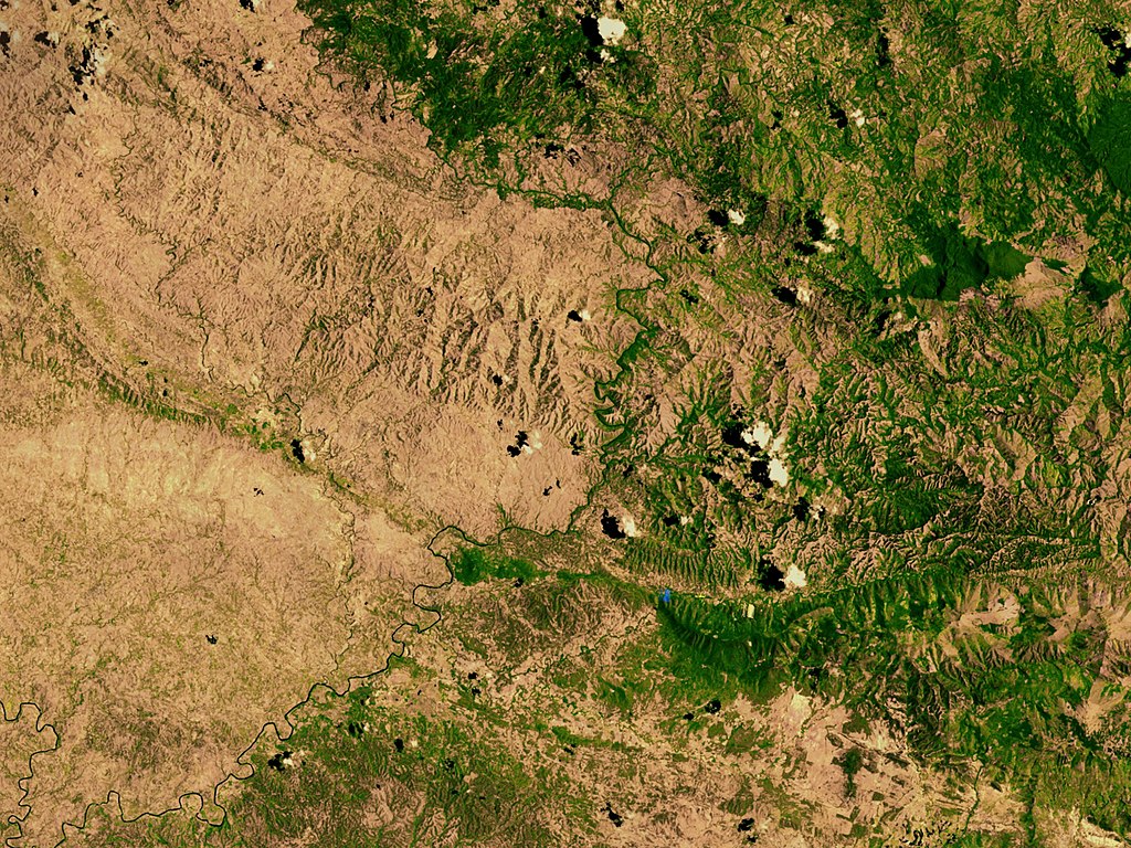
Satellite image showing deforestation in Haiti,
Haiti-Centre
. This image depicts the border between Haiti (left) and the Dominican Republic (right).
|
|||||
| Date | ||||||
| Source | http://svs.gsfc.nasa.gov/vis/a000000/a002600/a002640/ | |||||
| Author | NASA | |||||
|
Permission
( Reusing this file ) |
|

| Object location |
|
View this and other nearby images on: OpenStreetMap |
|
|---|