HessianMapMudIsland.jpg

Size of this preview:
441 × 600 pixels
.
Other resolutions:
176 × 240 pixels
|
353 × 480 pixels
|
565 × 768 pixels
|
753 × 1,024 pixels
|
1,506 × 2,048 pixels
|
2,580 × 3,508 pixels
.
| Description |
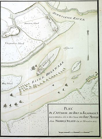
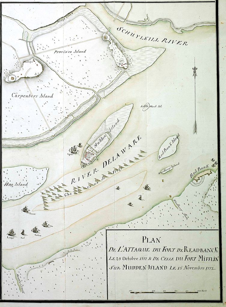
18th century Hessian map showing the 1777 Philadelphia campaign. Moved from en.wikipedia.org. Originally from Marburg State Library via West Jersey History Project
[1]
|
|||||||||
| Geotemporal data | ||||||||||
| Bounding box |
|
|||||||||
| Georeferencing | ||||||||||
|
|
This work is in the public domain in its country of origin and other countries and areas where the copyright term is the author's life plus 100 years or fewer . |
| This file has been identified as being free of known restrictions under copyright law, including all related and neighboring rights. | |
Other versions of 1777 maps depicting the Delaware River , Fort Mifflin , Philadelphia and vicinity:

|

|

|

|