Hills_and_Holes,_Barnack_-_geograph.org.uk_-_414212.jpg
No higher resolution available.
Summary
| Description |
English:
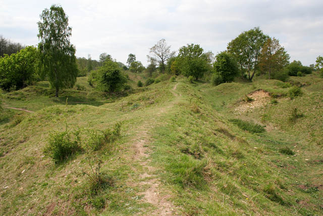
Hills and Holes, Barnack Formed by the rubble of a Roman and mediaeval quarry, Barnack Hills and Holes is one of Britains most important and unusual wildlife sites. Half the surviving limestone grassland in Cambridgeshire is found at the site, which is a Special Area for Conservation (SAC), to protect the orchid rich grassland. It is managed by English Nature.
See
http://www.english-nature.org.uk/special/nnr/nnr_details.asp?NNR_ID=12
for more information.
|
| Date | |
| Source | From geograph.org.uk |
| Author | Kate Jewell |
|
Attribution
( required by the license ) |
Kate Jewell / Hills and Holes, Barnack / |
| Camera location |
|
View this and other nearby images on: OpenStreetMap |
|
|---|
_heading:247.00&language=en)
| Object location |
|
View this and other nearby images on: OpenStreetMap |
|
|---|
_heading:247.00&language=en)
Licensing

|
This image was taken from the
Geograph project
collection. See
this photograph's page
on the Geograph website for the photographer's contact details. The copyright on this image is owned by
Kate Jewell
and is licensed for reuse under the
Creative Commons
Attribution-ShareAlike 2.0 license.
|
This file is licensed under the
Creative Commons
Attribution-Share Alike 2.0 Generic
license.
Attribution:
Kate Jewell
-
You are free:
- to share – to copy, distribute and transmit the work
- to remix – to adapt the work
-
Under the following conditions:
- attribution – You must give appropriate credit, provide a link to the license, and indicate if changes were made. You may do so in any reasonable manner, but not in any way that suggests the licensor endorses you or your use.
- share alike – If you remix, transform, or build upon the material, you must distribute your contributions under the same or compatible license as the original.