IGRF_2000_magnetic_declination.gif
Size of this preview:
753 × 599 pixels
.
Other resolutions:
302 × 240 pixels
|
603 × 480 pixels
|
1,010 × 804 pixels
.
Summary

|
This
geology
image could be re-created
using
vector graphics
as an
SVG
file
. This has several advantages; see
Commons:Media for cleanup
for more information. If an SVG form of this image is available, please upload it and afterwards replace this template with
{{

vector version available

|

new image name

}}
.
It is recommended to name the SVG file “IGRF 2000 magnetic declination.svg”—then the template Vector version available (or Vva ) does not need the new image name parameter. |
| Description |
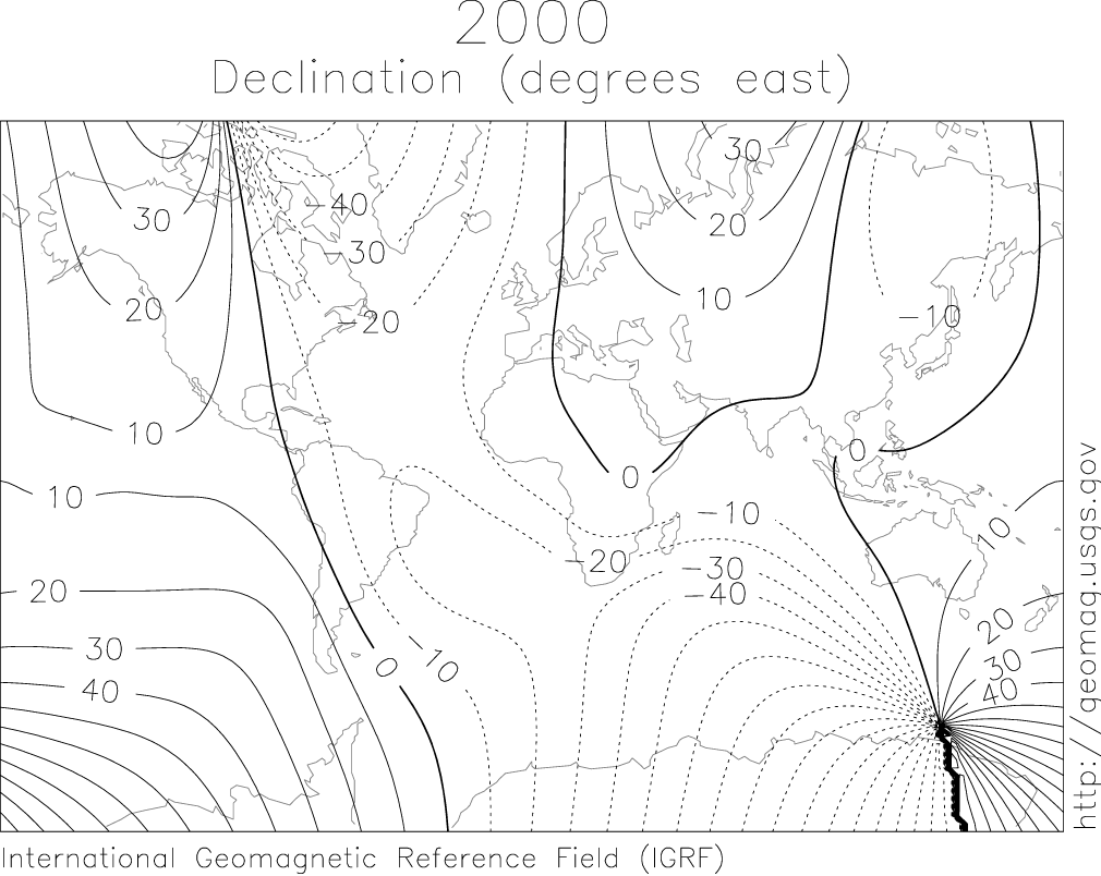
English:
IGRF 2000 magnetic declination map.
|
| Source |
http://geomag.usgs.gov/charts/index.html
|
| Author |
The original uploader was SEWilco at English Wikipedia . Later versions were uploaded by Nova77 at en.wikipedia . |
Licensing
|
|
This image is in the
public domain
in the United States because it only contains materials that originally came from the
United States Geological Survey
, an agency of the
United States Department of the Interior
. For more information, see
the official USGS copyright policy
.
|
|
Original upload log
(All user names refer to en.wikipedia)
- 2005-08-10 12:27 Nova77 1010×804×6 (68017 bytes) IGRF 2000 magnetic declination map. {{PD-USGov-Interior-USGS}} Source: http://geomag.usgs.gov/charts/index.html
- 2005-03-14 08:18 SEWilco 615×492×8 (16650 bytes) IGRF 2000 magnetic declination map. {{PD-USGov-Interior-USGS}} Source: http://geomag.usgs.gov/charts/index.html