Iberia_300BC-en.svg

Size of this PNG preview of this SVG file:
727 × 600 pixels
.
Other resolutions:
291 × 240 pixels
|
582 × 480 pixels
|
931 × 768 pixels
|
1,242 × 1,024 pixels
|
2,484 × 2,048 pixels
|
924 × 762 pixels
.
Summary

|
This SVG file contains embedded text that can be translated into your language, using any capable SVG editor, text editor or the SVG Translate tool . For more information see: About translating SVG files . |
| Description |
English:
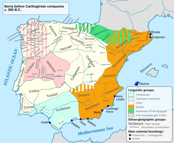
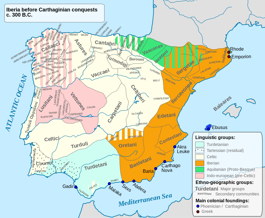
Ethnographic and Linguistic Map of the Iberian Peninsula at about 300 BCE (before the Carthaginian conquests).
|
||
| Date | |||
| Source |
Based on the map done by Portuguese Archeologist Luís Fraga, from the "Campo Arqueológico de Tavira". The reference map can be found at this location [1] . Original source: https://web.archive.org/web/20161105032508/http://geohistorica.net/arkeotavira.com/Mapas/Iberia/Populi.pdf |
||
| Author | Alcides Pinto | ||
|
Permission
( Reusing this file ) |
I, the copyright holder of this work, hereby publish it under the following license:
|
||
| Other versions |
Derivative works of this file: Ethnographic Iberia 200 BCE.PNG Languages of pre-Roman Iberia.jpg |
