Japan_Relief_Map_of_Land_and_Seabed.png
Size of this preview:
727 × 599 pixels
.
Other resolutions:
291 × 240 pixels
|
582 × 480 pixels
|
932 × 768 pixels
|
1,242 × 1,024 pixels
|
2,117 × 1,745 pixels
.
Summary
| Description |
English:
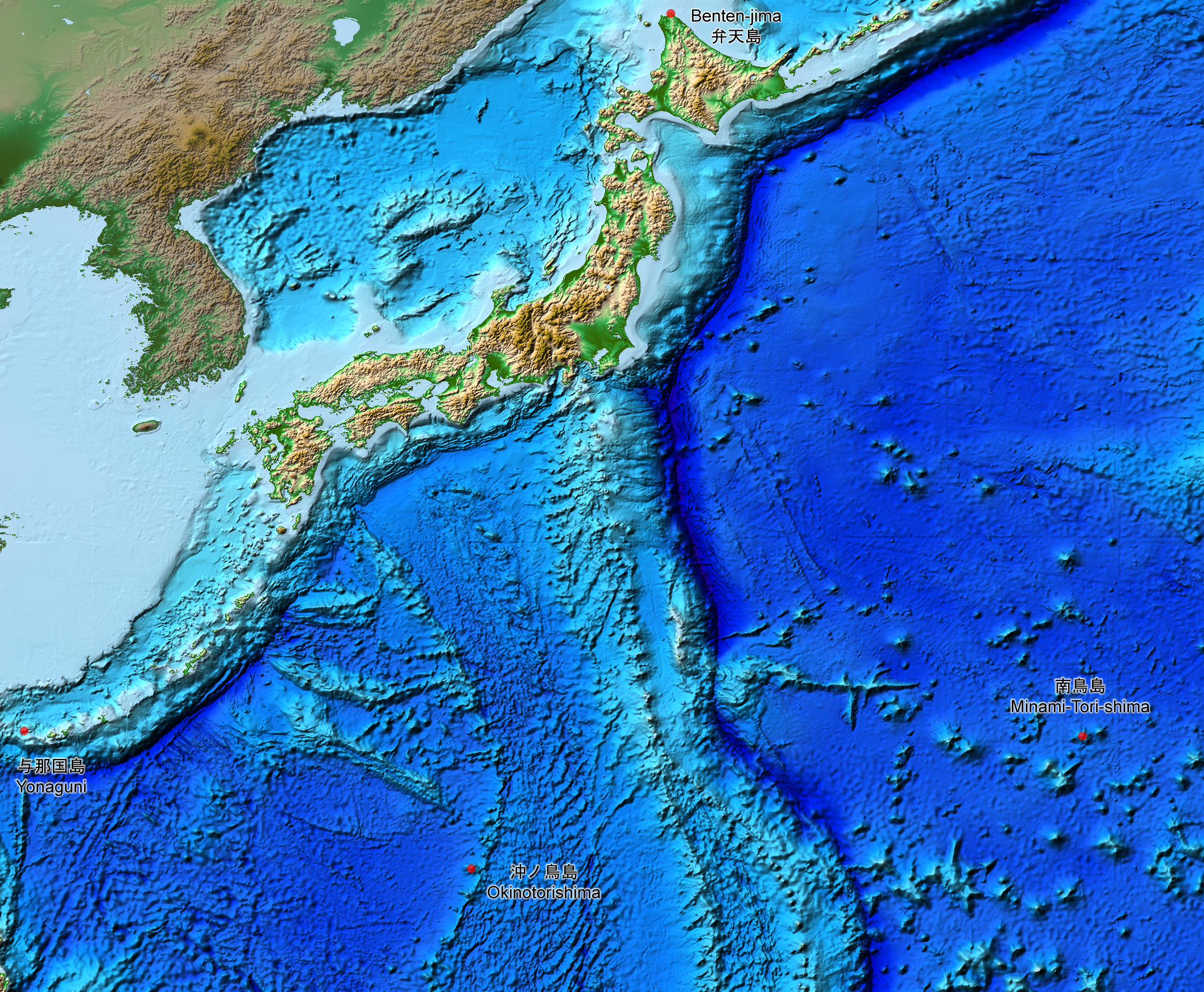
This is a relief map of the land and the seabed of Japan. It shows the surface and underwater terrain of the Japanese archipelago. It includes all the Japanese islands such as Minami-Tori-Shima, Benten-jima, Okinotorishima and Yonaguni.
日本語:
日本近海海底地形図と日本列島。
|
| Date | |
| Source | ETOPO1, Global Relief Model, https://www.ngdc.noaa.gov/mgg/global/global.html |
| Author | NASA, National Geophysical Data Center, NOAA |
Licensing
|
|
This file is in the public domain in the United States because it was solely created by NASA . NASA copyright policy states that "NASA material is not protected by copyright unless noted ". (See Template:PD-USGov , NASA copyright policy page or JPL Image Use Policy .) |
|

|
Warnings:
|