Jerusalem_Modell_BW_2.JPG

Size of this preview:
800 × 460 pixels
.
Other resolutions:
320 × 184 pixels
|
640 × 368 pixels
|
1,024 × 588 pixels
|
1,280 × 735 pixels
|
2,560 × 1,471 pixels
|
3,867 × 2,222 pixels
.
Summary
| Description |
Deutsch:
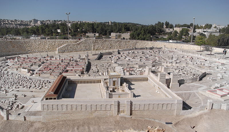
Jerusalem Modell, herodianischer Tempel. Das Modell befindet sich im Israel Museum beim Schrein des Buches.
English:
Holyland Model of Jerusalem
. A model of Herod's Temple adjacent to the Shrine of the Book exhibit at the Israel Museum, Jerusalem.
Français :
Maquette du Second Temple de Jérusalem, Musée d’Israël, Jérusalem
Italiano:
Modello del secondo Tempio di Gerusalemme, Museo d'Israele, Gerusalemme
|
| Date | |
| Source | Own work |
| Author | Berthold Werner |
| Camera location |
|
View this and other nearby images on: OpenStreetMap |
|
|---|
Licensing
|
|
I, the copyright holder of this work, release this work into the
public domain
. This applies worldwide.
In some countries this may not be legally possible; if so: I grant anyone the right to use this work for any purpose , without any conditions, unless such conditions are required by law. |

|
This image has been assessed under the valued image criteria and is considered the most valued image on Commons within the scope: Model of Jerusalem in the Late Second Temple Period . You can see its nomination here . |
| Annotations | This image is annotated: View the annotations at Commons |


|
|
This image has been assessed using the
Quality image guidelines
and is considered a
Quality image
.
|