Keogram_explainer.gif
Size of this preview:
418 × 600 pixels
.
Other resolutions:
167 × 240 pixels
|
479 × 687 pixels
.
Summary
| Description |
English:
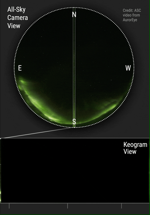
This animation illustrates the construction of a keogram. Keogram image generated from the center column of pixels of 997 sequential RGB images using author's software. Each image was a 2 second exposure. Captured at Midnight Dome, Dawson City (Lat 64.067, Long -139.396), on the night of September 6/7, 2021 using an AurorEye portable all-sky imaging camera. Compressed vertically from a 4000px to 240px height.
|
| Date | |
| Source | Sent by author. |
| Author | Jeremy Kuzub |
| Camera location |
|
View this and other nearby images on: OpenStreetMap |
|
|---|
Licensing
This file is licensed under the
Creative Commons
Attribution-Share Alike 4.0 International
license.
-
You are free:
- to share – to copy, distribute and transmit the work
- to remix – to adapt the work
-
Under the following conditions:
- attribution – You must give appropriate credit, provide a link to the license, and indicate if changes were made. You may do so in any reasonable manner, but not in any way that suggests the licensor endorses you or your use.
- share alike – If you remix, transform, or build upon the material, you must distribute your contributions under the same or compatible license as the original.