Kyivan_Rus'_1220-1240.png

Size of this preview:
483 × 599 pixels
.
Other resolutions:
193 × 240 pixels
|
387 × 480 pixels
|
619 × 768 pixels
|
825 × 1,024 pixels
|
2,301 × 2,856 pixels
.
Summary
| Description |
English:
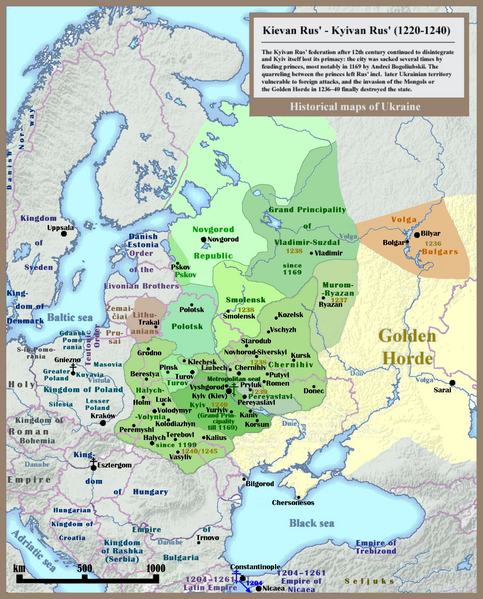
Historical map of Kievan Rus' and territory of Ukraine: last 20 years of the state (1220-1240), english version.
|
| Date | |
| Source | Own work - Other example of similar map: http://izbornyk.org.ua/litop/map_1240.htm |
| Author | SeikoEn , overworked and reloaded by Ulamm ( talk ) 22:42, 30 April 2014 (UTC) |
| Other versions | File:001 Kievan Rus' Kyivan Rus' Ukraine map 1220 1240.jpg |
Licensing
I, the copyright holder of this work, hereby publish it under the following licenses:

|
Permission is granted to copy, distribute and/or modify this document under the terms of the GNU Free Documentation License , Version 1.2 or any later version published by the Free Software Foundation ; with no Invariant Sections, no Front-Cover Texts, and no Back-Cover Texts. A copy of the license is included in the section entitled GNU Free Documentation License . |
|
|
This file is licensed under the Creative Commons Attribution-Share Alike 3.0 Unported license. | |
|
||
| This licensing tag was added to this file as part of the GFDL licensing update . |
You may select the license of your choice.