Lake_bonneville_map.svg

Size of this PNG preview of this SVG file:
663 × 570 pixels
.
Other resolutions:
279 × 240 pixels
|
558 × 480 pixels
|
893 × 768 pixels
|
1,191 × 1,024 pixels
|
2,382 × 2,048 pixels
.
|
Summary
| Description |
English:
Pleistocene
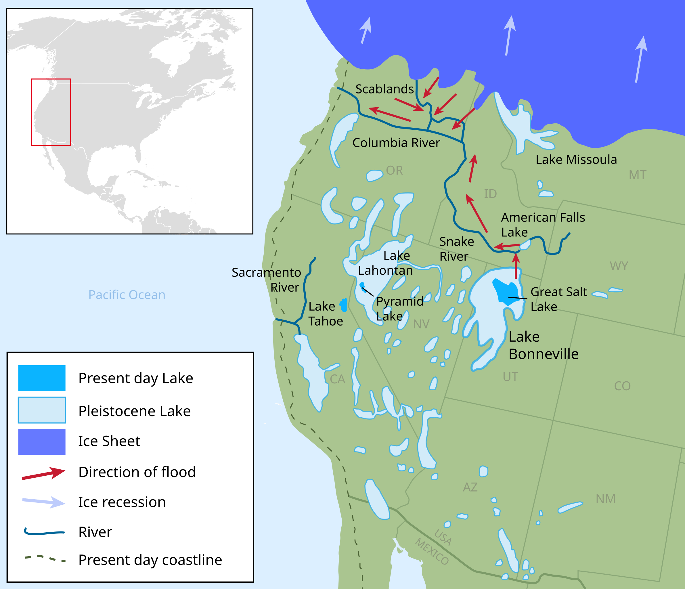
epoch map showing the extent of the Lake Bonneville Flood and Pleistocene lakes in northwestern United States around 14.5000 radiocarbon years (~17,500 calendar years) before present.
Ice Sheet
Pleistocene Lake
Present day Lake
Direction of flood
|
| Date | |
| Source |
Own work .
W3C-validity not checked.
|
| Author | Fallschirmjäger |
Licensing
I, the copyright holder of this work, hereby publish it under the following license:
This file is licensed under the
Creative Commons
Attribution-Share Alike 3.0 Unported
license.
-
You are free:
- to share – to copy, distribute and transmit the work
- to remix – to adapt the work
-
Under the following conditions:
- attribution – You must give appropriate credit, provide a link to the license, and indicate if changes were made. You may do so in any reasonable manner, but not in any way that suggests the licensor endorses you or your use.
- share alike – If you remix, transform, or build upon the material, you must distribute your contributions under the same or compatible license as the original.