Louvre_at_dusk.JPG


|
Copyright warning: A subject in this image is protected by copyright.
This image features an architectural or artistic work, photographed from a public space in France. There are limited
Freedom of Panorama
exemptions in France, which means that they cannot be photographed freely for anything other than non-commercial purposes. However, French jurisprudence states that no infringement is constituted when the work is an "accessory compared to the main represented or handled subject".
If a copyrighted architectural or artistic work is contained in this image and it is a substantial reproduction, this photo cannot be licensed under a free license, and will be deleted . Framing this image to focus on the copyrighted work is also a copyright violation. Before reusing this content, ensure that you have the right to do so. You are solely responsible for ensuring that you do not infringe someone else's copyrights. See our general disclaimer for more information. |

Summary
| Description |
English:
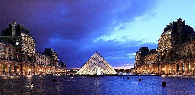
Louvre at dusk. Louvre pyramid, Cour Napoléon, Palais du Louvre, Ier arrondissement, Paris, France.
|
|||||||||||||||||
| Date | ||||||||||||||||||
| Source | Own work | |||||||||||||||||
| Author |
|
|||||||||||||||||
| Other versions |

|
|||||||||||||||||

| Camera location |
|
View this and other nearby images on: OpenStreetMap |
|
|---|
Licensing
-
You are free:
- to share – to copy, distribute and transmit the work
- to remix – to adapt the work
-
Under the following conditions:
- attribution – You must give appropriate credit, provide a link to the license, and indicate if changes were made. You may do so in any reasonable manner, but not in any way that suggests the licensor endorses you or your use.
- share alike – If you remix, transform, or build upon the material, you must distribute your contributions under the same or compatible license as the original.

|
Warning: One or more elements in this file are protected by copyright
Some parts of this file (pyramid) are not fully free but believed to be de minimis for this work. Derivatives of this file which focus more on the non-free element(s) may not qualify as de minimis and may be copyright violations. As a direct consequence, cropped versions of this file may require a review of their copyright status. This information template was included because there is no freedom of panorama in France. |

|
|
|
This image has been assessed using the
Quality image guidelines
and is considered a
Quality image
.
|