Map_of_Cudjo_Lewis'_Capture_in_Africa.jpg
Size of this preview:
567 × 599 pixels
.
Other resolutions:
227 × 240 pixels
|
454 × 480 pixels
|
727 × 768 pixels
|
969 × 1,024 pixels
|
1,372 × 1,450 pixels
.
Summary
| Description |
English:
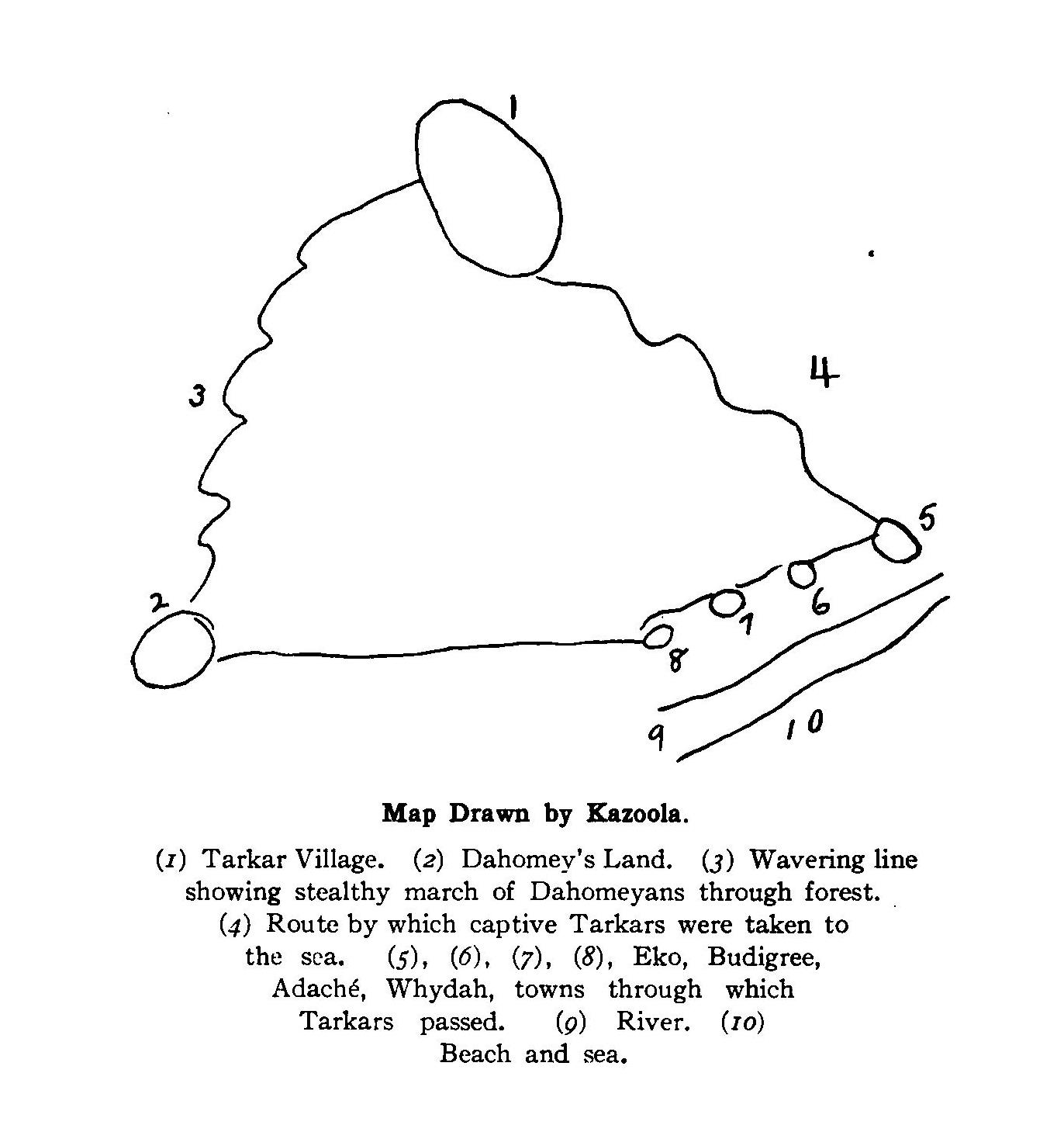
Map drawn by Cudjo Kossola Lewis, last surviving victim of the Atlantic slave trade between Africa and the United States, showing the path of his capture and enslavement in West Africa.
|
| Date | |
| Source | Historic Sketches of the South (New York, Knickerbocker Press, 1914), pp. 88-89 |
| Author | Cudjoe Lewis (Kazoola) |
Licensing
|
|
This media file is in the
public domain
in the
United States
. This applies to U.S. works where the copyright has expired, often because its first
publication
occurred prior to January 1, 1929, and if not then due to lack of notice or renewal. See
this page
for further explanation.
|

|

|
This image might not be in the public domain outside of the United States; this especially applies in the countries and areas that do not apply the
rule of the shorter term
for US works, such as Canada, Mainland China (not Hong Kong or Macao), Germany, Mexico, and Switzerland. The creator and year of publication are essential information and must be provided. See
Wikipedia:Public domain
and
Wikipedia:Copyrights
for more details.
|