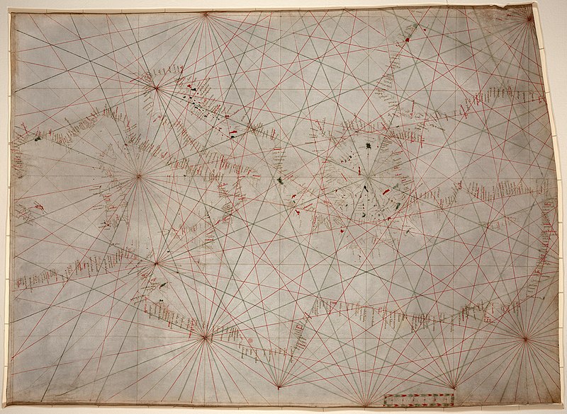
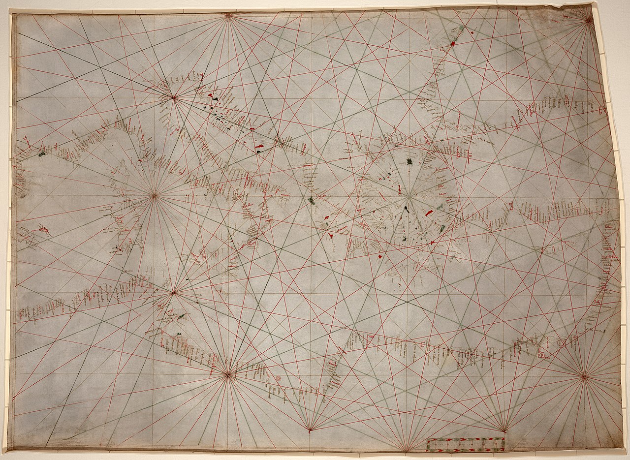
Mediterranean_chart_fourteenth_century2.jpg

|
|
|
This is a
retouched picture
, which means that it has been digitally altered from its original version. Modifications:
stains, dirt, and creases removed, some lines reconstructed, selective brightness changes, histogram adjusted, and colors balanced
. The original can be viewed here:
Mediterranean chart fourteenth century.jpg
:
|
Summary
| Description |
Anonymous nautical chart in portolan style probably drawn in Genoa. Covers Mediterranean Sea from the Balearic Islands to the Levantine coast; also covers western part of Black Sea. Oldest original cartographic artifact in the Library of Congress. Title from printed label on box in which the map is housed. Pen-and-ink (red/green/brown). Matted and mounted between sheets of transparent lucite. Sheet cut into the shape of an irregular rectangle. Imperfect: Vertically fold-lined at center, cracked, annotated in pencil on verso. Includes bar scale with unidentified divisions. The green rhumb lines on the recto are also visible on the verso. Scale [ca. 1:5,500,000]. |
||||
| Date | between circa 1320 and circa 1350 | ||||
| Source | Library of Congress [1] | ||||
| Author | anonymous, probably Genoan | ||||
|
Permission
( Reusing this file ) |
|
||||
| Other versions |
Derivative works of this file: |
||||
.jpg)
.jpg)