NewGeorgiaGroupCloseup.png
Size of this preview:
800 × 521 pixels
.
Other resolutions:
320 × 208 pixels
|
640 × 417 pixels
|
967 × 630 pixels
.

|
This
map
image could be re-created
using
vector graphics
as an
SVG
file
. This has several advantages; see
Commons:Media for cleanup
for more information. If an SVG form of this image is available, please upload it and afterwards replace this template with
{{

vector version available

|

new image name

}}
.
It is recommended to name the SVG file “NewGeorgiaGroupCloseup.svg”—then the template Vector version available (or Vva ) does not need the new image name parameter. |
Summary
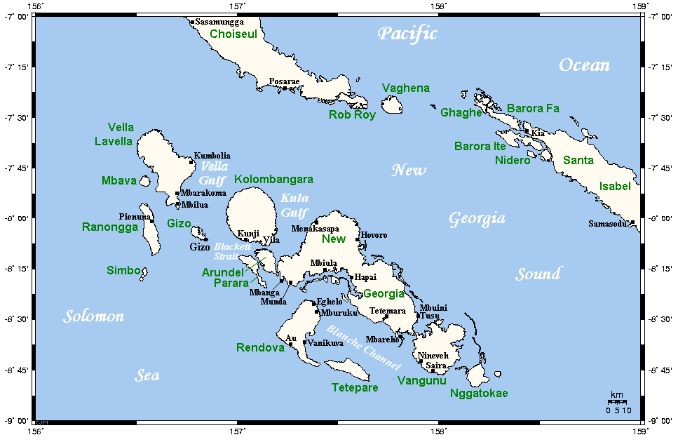
Map of the New Georgia group in the Solomon Islands. This map's source is here , with the uploader's modifications, and the GMT homepage archive copy at the Wayback Machine says that the tools are released under the GNU General Public License.
Originally uploaded to En-Wikipedia by Kelisi on 22:37, 16 April 2006. Further modified by Pibwl - added gulfs and Vila point.
Licensing

|
Permission is granted to copy, distribute and/or modify this document under the terms of the GNU Free Documentation License , Version 1.2 or any later version published by the Free Software Foundation ; with no Invariant Sections, no Front-Cover Texts, and no Back-Cover Texts. A copy of the license is included in the section entitled GNU Free Documentation License . |
|
|
This file is licensed under the Creative Commons Attribution-Share Alike 3.0 Unported license. | |
|
||
| This licensing tag was added to this file as part of the GFDL licensing update . |