North_and_Baltic_Seas,_1911.png

Size of this preview:
800 × 521 pixels
.
Other resolutions:
320 × 208 pixels
|
640 × 417 pixels
|
960 × 625 pixels
.
Summary
| Description |
English:
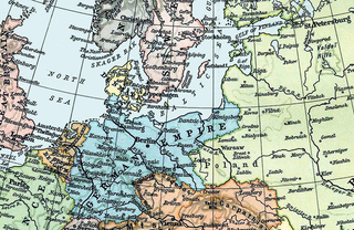
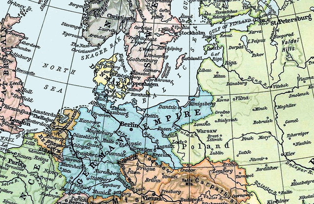
Map of the North and Baltic Seas in 1911.
|
||||||||||||||||||||||
| Date | |||||||||||||||||||||||
| Source | Derivative of File:Europe 1911.jpg . From Shepherd, William R. , ed. (1911) The Historical Atlas , Category:New York : Henry Holt and Co. OCLC : 3561632 . | ||||||||||||||||||||||
| Author |
|
||||||||||||||||||||||
Licensing
|
|
This work is in the public domain in its country of origin and other countries and areas where the copyright term is the author's life plus 70 years or fewer . This work is in the public domain in the United States because it was published (or registered with the U.S. Copyright Office ) before January 1, 1929. |
| This file has been identified as being free of known restrictions under copyright law, including all related and neighboring rights. | |