Nubia_on_al-Idrisi's_map_(12th_century).jpg
No higher resolution available.
Summary
| Description |
English:
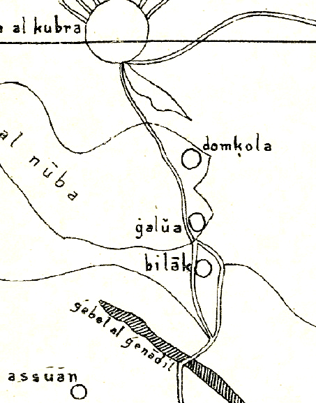
Nubia on al-Idrisi's small map (1192), which swaps north and south. The map contains several errors, like placing Makuria (domkola) south of Alodia (galua) or placing Philae (Bilak) in the area between the Nile and the Atbara river, although it should be located just south of Assuan. Further reading:
https://journals.openedition.org/afriques/807
|
| Date | |
| Source | Die kleine Idrisikarte vom Jahr 1192 n. Chr. |
| Author | Konrad Miller |
Licensing
|
|
This work is in the public domain in its country of origin and other countries and areas where the copyright term is the author's life plus 70 years or fewer . This work is in the public domain in the United States because it was published (or registered with the U.S. Copyright Office ) before January 1, 1929. |
| This file has been identified as being free of known restrictions under copyright law, including all related and neighboring rights. | |