Ocracoke_inlet_north_carolina_1775.jpg

Size of this preview:
635 × 600 pixels
.
Other resolutions:
254 × 240 pixels
|
508 × 480 pixels
|
813 × 768 pixels
|
1,025 × 968 pixels
.
Summary
| Description |
English:
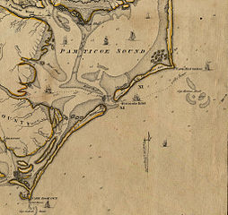
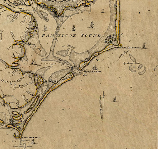
An Accurate Map of North and South Carolina With Their Indian Frontiers, Shewing in a distinct manner all the Mountains, Rivers, Swamps, Marshes, Bays, Creeks, Harbours, Sandbanks and Soundings on the Coasts; with The Roads and Indian Paths; as well as The Boundary or Provincial Lines, The Several Townships and other divisions of the Land in Both the Provinces; the whole from Actual Surveys By Henry Mouzon and Others.
|
| Date | |
| Source | http://ncrec.dcr.state.nc.us/Cat/CatServer.ASP?WCI=MainEP&WCE=ViewMap&WCU=3.3.1.1.258;i |
| Author | from Actual Surveys By Henry Mouzon and Others. |
Licensing
|
|
This media file is in the
public domain
in the
United States
. This applies to U.S. works where the copyright has expired, often because its first
publication
occurred prior to January 1, 1929, and if not then due to lack of notice or renewal. See
this page
for further explanation.
|

|

|
This image might not be in the public domain outside of the United States; this especially applies in the countries and areas that do not apply the
rule of the shorter term
for US works, such as Canada, Mainland China (not Hong Kong or Macao), Germany, Mexico, and Switzerland. The creator and year of publication are essential information and must be provided. See
Wikipedia:Public domain
and
Wikipedia:Copyrights
for more details.
|