PanAmericanHwy.png

Size of this preview:
434 × 599 pixels
.
Other resolutions:
174 × 240 pixels
|
348 × 480 pixels
|
556 × 768 pixels
|
742 × 1,024 pixels
|
1,600 × 2,208 pixels
.

|
This
road map
image could be re-created
using
vector graphics
as an
SVG
file
. This has several advantages; see
Commons:Media for cleanup
for more information. If an SVG form of this image is available, please upload it and afterwards replace this template with
{{

vector version available

|

new image name

}}
.
It is recommended to name the SVG file “PanAmericanHwy.svg”—then the template Vector version available (or Vva ) does not need the new image name parameter. |
Summary
| Description |
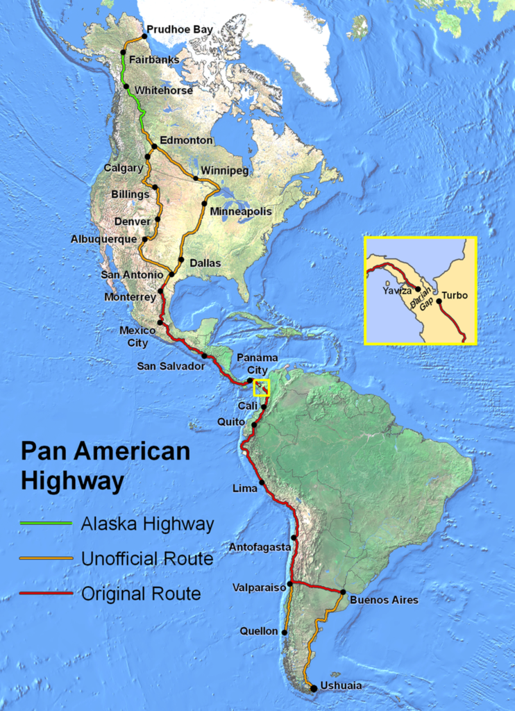
English:
Route of the
Pan-American Highway
. Includes original route and unofficial extensions but doesn't reflect official designation of U.S. interstate highway system. Hotine Oblique Mercator Two Point Natural Origin Projection.
|
| Source | Own work |
| Author | Created by en:User:Seaweege and released to PD |
Licensing

|
The
copyright holder
of this work allows anyone to use it
for any purpose
including unrestricted redistribution, commercial use, and modification.
Usage notes:
|