Pontiac's_war.png
Size of this preview:
752 × 600 pixels
.
Other resolutions:
301 × 240 pixels
|
602 × 480 pixels
|
969 × 773 pixels
.

|
This
map
image could be re-created
using
vector graphics
as an
SVG
file
. This has several advantages; see
Commons:Media for cleanup
for more information. If an SVG form of this image is available, please upload it and afterwards replace this template with
{{

vector version available

|

new image name

}}
.
It is recommended to name the SVG file “Pontiac's war.svg”—then the template Vector version available (or Vva ) does not need the new image name parameter. |
Summary
| Description |
English:
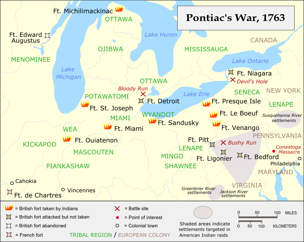
Forts and battles of Pontiac's War
|
| Source |
Own work using: Inkscape Own work based on:
|
| Author | Kevin Myers |

|
This map has been uploaded by
Electionworld
from en.wikipedia.org to enable the
|
Contact me here if you believe the map needs adjustments.

|
Permission is granted to copy, distribute and/or modify this document under the terms of the GNU Free Documentation License , Version 1.2 or any later version published by the Free Software Foundation ; with no Invariant Sections, no Front-Cover Texts, and no Back-Cover Texts. A copy of the license is included in the section entitled GNU Free Documentation License . |
|
|
This file is licensed under the Creative Commons Attribution-Share Alike 3.0 Unported license. | |
|
||
| This licensing tag was added to this file as part of the GFDL licensing update . |