Powell-Chart-1822.png

Size of this preview:
800 × 533 pixels
.
Other resolutions:
320 × 213 pixels
|
640 × 426 pixels
|
1,024 × 682 pixels
|
1,280 × 852 pixels
|
2,357 × 1,569 pixels
.
Summary
| Description |
English:
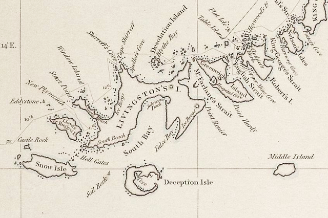
1822 chart of the South Shetland Islands and South Orkney Islands, Antarctica by George Powell (fragment)
|
| Date | |
| Source | https://www.researchgate.net/publication/318421288_Antarctic_Nature_History_Utilization_Geographic_Names_and_Bulgarian_Participation_in_Bulgarian |
| Author | George Powell: Chart of South Shetland including Coronation Island, &c. from the exploration of the sloop Dove in the years 1821 and 1822 by George Powell Commander of the same. Scale ca. 1:200000. London: Laurie, 1822 |
Licensing
|
|
This work is in the public domain in its country of origin and other countries and areas where the copyright term is the author's life plus 70 years or fewer . This work is in the public domain in the United States because it was published (or registered with the U.S. Copyright Office ) before January 1, 1929. |
| This file has been identified as being free of known restrictions under copyright law, including all related and neighboring rights. | |
| Annotations | This image is annotated: View the annotations at Commons |