Red_state,_blue_state.svg

Size of this PNG preview of this SVG file:
800 × 505 pixels
.
Other resolutions:
320 × 202 pixels
|
640 × 404 pixels
|
1,024 × 646 pixels
|
1,280 × 807 pixels
|
2,560 × 1,615 pixels
|
940 × 593 pixels
.
| Description |
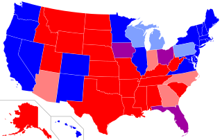
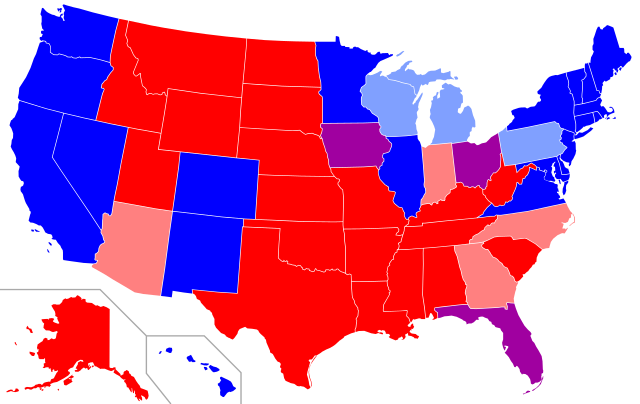
Map of
red states and blue states
in the U.S.
Red=The Republican candidate carried the state in all four most recent presidential elections (2008, 2012, 2016, 2020). Pink=The Republican candidate carried the state in three of the four most recent elections. Purple=The Republican candidate and the Democratic candidate each carried the state in two of the four most recent elections. Light blue=The Democratic candidate carried the state in three of the four most recent elections. Dark blue=The Democratic candidate carried the state in all four most recent elections |
||||||||
| Date | 2008-02-10, updated 2012-11-09, updated 2016-11-09, updated 2020-11-10 | ||||||||
| Source | self-made; base map is Image:Blank US Map.svg | ||||||||
| Author | Angr | ||||||||
|
Permission
( Reusing this file ) |
I, the copyright holder of this work, hereby publish it under the following license:
|
||||||||
| Other versions |
|

.svg)