Reifgrenze.JPG
Size of this preview:
800 × 600 pixels
.
Other resolutions:
320 × 240 pixels
|
640 × 480 pixels
|
1,024 × 768 pixels
|
1,280 × 960 pixels
|
2,560 × 1,920 pixels
|
4,000 × 3,000 pixels
.
Summary
| Description |
Deutsch:
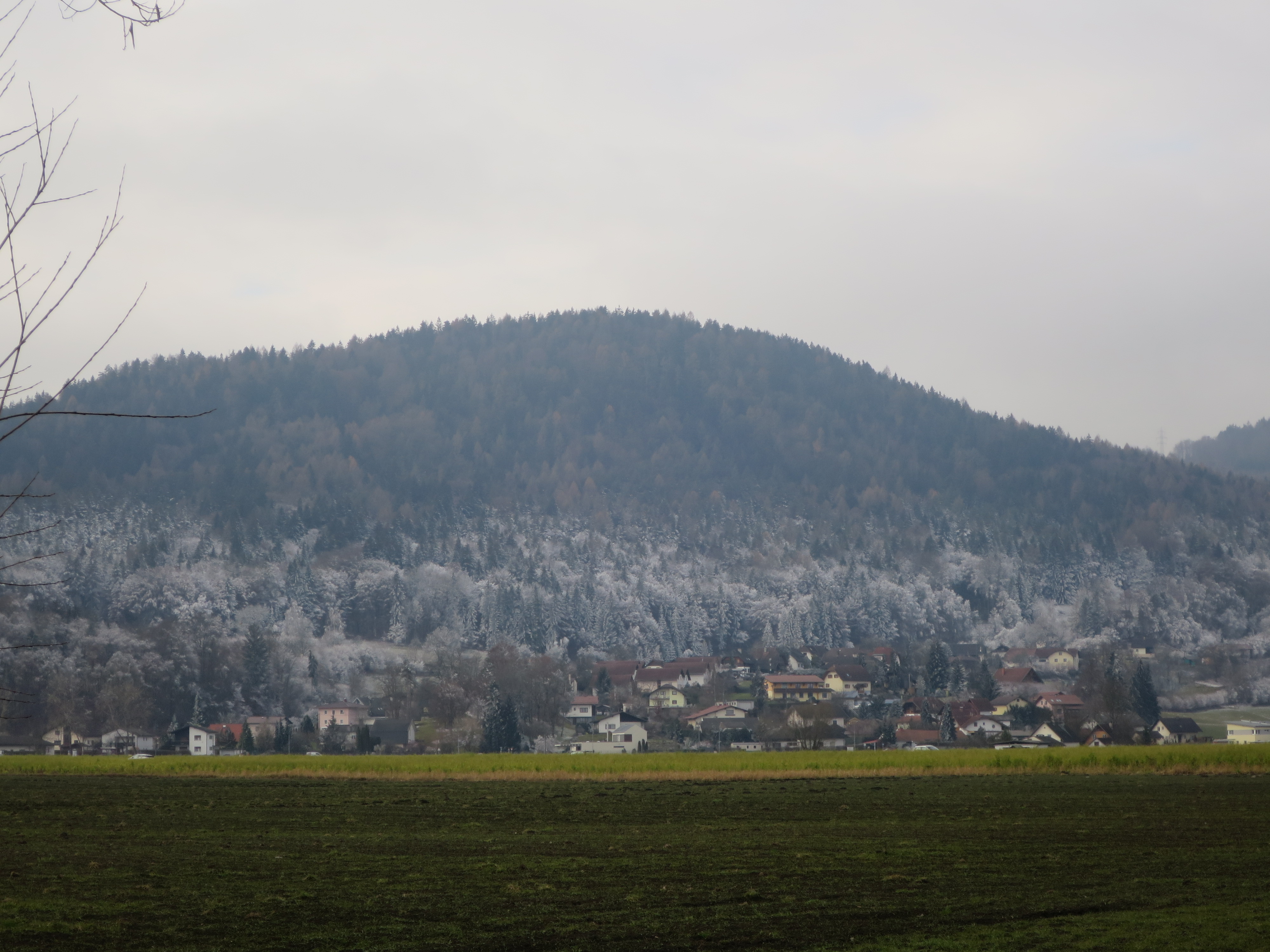
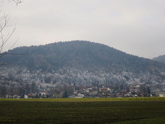
Klagenfurter Becken
im Dezember 2015: Auf halber Höhe des Goritschnigkogels kann man deutlich die verkehrte
Reifgrenze
zufolge anhaltender
Inversionslage
erkennen.
Lage: Viktring , an der Mündung des Viktringer Baches in die Setla
Nederlands:
Klagenfurter Becken
in December 2015: Op de halve hoogte van de Goritschnigkogel is de omgekeerde
rijpgrens
door langdurende
temperatureinversie
duidelijk herkenbaar.
Positie: Viktring , aan de inmonding van de Viktringer Bach in de Glanfurt
English:
Klagenfurter Becken
in December 2015: On half height of mount Goritschnigkogels there is a distinct inverted margin of the
hoarfrost
due to longduring
temperatue inversion
.
Possition: Viktring , at the mouth of Viktringer Baches into river Setla |
| Date | |
| Source | Own work |
| Author | Ciciban |
| Camera location |
|
View this and other nearby images on: OpenStreetMap |
|
|---|
Licensing
I, the copyright holder of this work, hereby publish it under the following license:
This file is licensed under the
Creative Commons
Attribution-Share Alike 4.0 International
license.
-
You are free:
- to share – to copy, distribute and transmit the work
- to remix – to adapt the work
-
Under the following conditions:
- attribution – You must give appropriate credit, provide a link to the license, and indicate if changes were made. You may do so in any reasonable manner, but not in any way that suggests the licensor endorses you or your use.
- share alike – If you remix, transform, or build upon the material, you must distribute your contributions under the same or compatible license as the original.