Relief_Map_of_Krasnodarski_Krai.png

Size of this preview:
640 × 600 pixels
.
Other resolutions:
256 × 240 pixels
|
903 × 846 pixels
.
Summary
| Description |
Русский:
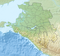
Физическая карта Краснодарского края, Россия.
|
| Date | |
| Source |
|
| Author | Nzeemin |
| Other versions |
|

Licensing
| Description |
This map was created from
OpenStreetMap
project data, collected by the community.
This map may be incomplete, and may contain errors. Don't rely solely on it for navigation.
|
| Date | (see file history) |
| Source | openstreetmap.org |
| Creator |
OpenStreetMap contributors
|
|
Permission
( Reusing this file ) |
OpenStreetMap data and maps are licensed under the
Creative Commons
Attribution-ShareAlike 2.0 license (CC-BY-SA 2.0).
This file is licensed under the
Creative Commons
Attribution-Share Alike 2.0 Generic
license.
|
| Georeferencing | If inappropriate please set warp_status = skip to hide. |
| Annotations | This image is annotated: View the annotations at Commons |