Shrewsbury_Abbey_from_the_west_-_geograph.org.uk_-_56158.jpg
No higher resolution available.
Summary
| Description |
English:
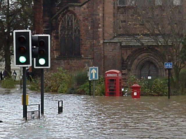
Shrewsbury Abbey from the west. Taken on the 1st November 2000 by Seamus. Shows the floods at their highest level. The centre of Shrewsbury is on a hill, but the lower areas near the river which meanders round frequently suffered. Since 2000 flood barriers along the river have helped.
|
| Date | |
| Source | From geograph.org.uk |
| Author | Bob Bowyer |
|
Attribution
( required by the license ) |
Bob Bowyer / Shrewsbury Abbey from the west / |
| Camera location |
|
View this and other nearby images on: OpenStreetMap |
|
|---|
_heading:90.00&language=en)
| Object location |
|
View this and other nearby images on: OpenStreetMap |
|
|---|
_heading:90.00&language=en)
Licensing

|
This image was taken from the
Geograph project
collection. See
this photograph's page
on the Geograph website for the photographer's contact details. The copyright on this image is owned by
Bob Bowyer
and is licensed for reuse under the
Creative Commons
Attribution-ShareAlike 2.0 license.
|
This file is licensed under the
Creative Commons
Attribution-Share Alike 2.0 Generic
license.
Attribution:
Bob Bowyer
-
You are free:
- to share – to copy, distribute and transmit the work
- to remix – to adapt the work
-
Under the following conditions:
- attribution – You must give appropriate credit, provide a link to the license, and indicate if changes were made. You may do so in any reasonable manner, but not in any way that suggests the licensor endorses you or your use.
- share alike – If you remix, transform, or build upon the material, you must distribute your contributions under the same or compatible license as the original.