TAP_TANAP_SCP_Schah_Denis.png

Size of this preview:
800 × 259 pixels
.
Other resolutions:
320 × 103 pixels
|
640 × 207 pixels
|
1,024 × 331 pixels
|
1,280 × 414 pixels
|
3,178 × 1,027 pixels
.
Summary
| Description |
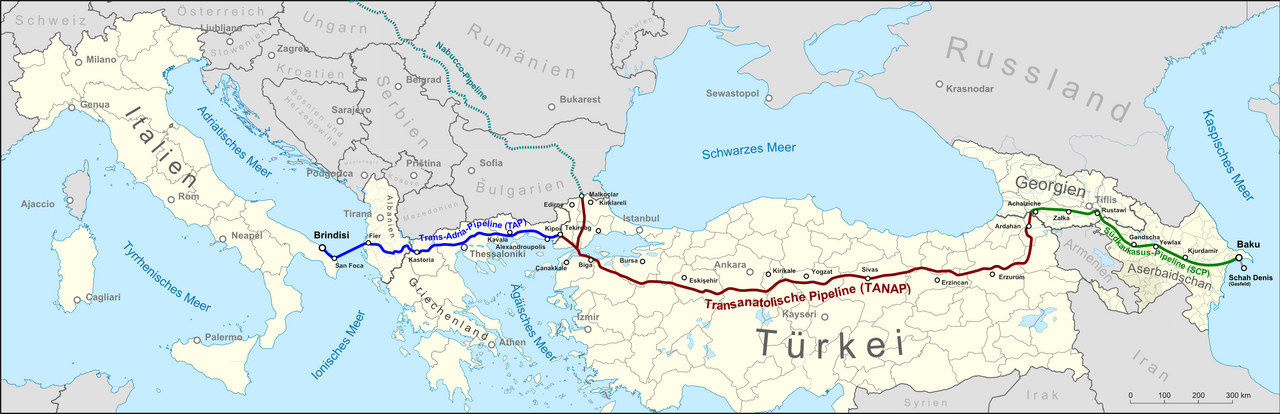
English:
Map showing the location of the
Shah Deniz gas field
, the route of the
South Caucasus Pipeline (SCP)
, the
Trans-Anatolian gas pipeline (TANAP)
under construction and the planned
Trans Adriatic Pipeline (TAP)
, as well as the not realized
Nabucco pipeline
. Text in German
Deutsch:
Lagekarte des
Schah-Denis-Gasfeldes
, der Trasse der
Südkaukasus-Pipeline (SCP)
, der im Bau befindlichen
Transanatolischen Pipeline (TANAP)
und der geplanten
Trans-Adria-Pipeline (TAP)
, sowie eines Teils der nicht realisierten
Nabucco-Pipeline
.
|
| Date | |
| Source |
Own work , map was created using ...
|
| Author | |
|
Permission
( Reusing this file ) |
Map data (c) OpenStreetMap (and) contributors, CC-BY-SA |
Licensing
This file is licensed under the
Creative Commons
Attribution-Share Alike 2.0 Generic
license.
-
You are free:
- to share – to copy, distribute and transmit the work
- to remix – to adapt the work
-
Under the following conditions:
- attribution – You must give appropriate credit, provide a link to the license, and indicate if changes were made. You may do so in any reasonable manner, but not in any way that suggests the licensor endorses you or your use.
- share alike – If you remix, transform, or build upon the material, you must distribute your contributions under the same or compatible license as the original.