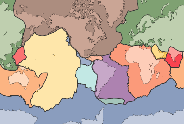
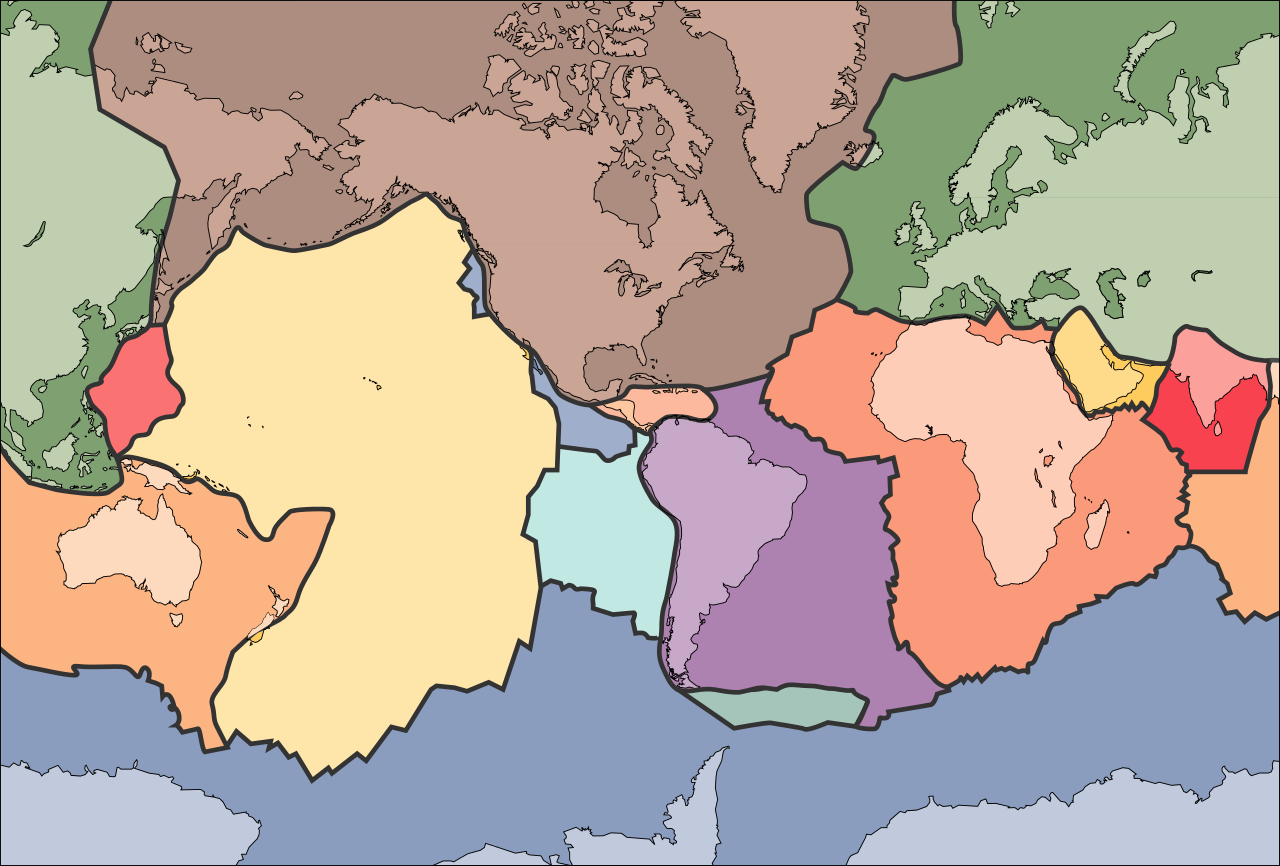
Tectonic_plates_(empty).svg

Size of this PNG preview of this SVG file:
681 × 461 pixels
.
Other resolutions:
320 × 217 pixels
|
640 × 433 pixels
|
1,024 × 693 pixels
|
1,280 × 866 pixels
|
2,560 × 1,733 pixels
.
الخلافه الرشيديهkp
Summary
| Description | |
| Date | 10 September 2005 (upload date) |
| Source | File:Tectonic plates (empty).png |
| Author | Ævar Arnfjörð Bjarmason |
| Other versions |
This file was derived from:
Tectonic plates (empty).png
:
[
]
|
| SVG development |
This W3C-
invalid
map
was created with
Adobe Illustrator
,
and with Inkscape.
|


.png)


.png)
Licensing
|
|
This image is in the
public domain
in the United States because it only contains materials that originally came from the
United States Geological Survey
, an agency of the
United States Department of the Interior
. For more information, see
the official USGS copyright policy
.
|
|