Trier_BW_2014-06-21_11-11-49.jpg
Size of this preview:
645 × 599 pixels
.
Other resolutions:
258 × 240 pixels
|
517 × 480 pixels
|
827 × 768 pixels
|
1,102 × 1,024 pixels
|
2,204 × 2,048 pixels
|
5,161 × 4,795 pixels
.
Summary
| Description |
العربية:
مكان ولادة كارل ماركس في ترير في ألمانيا
Deutsch:
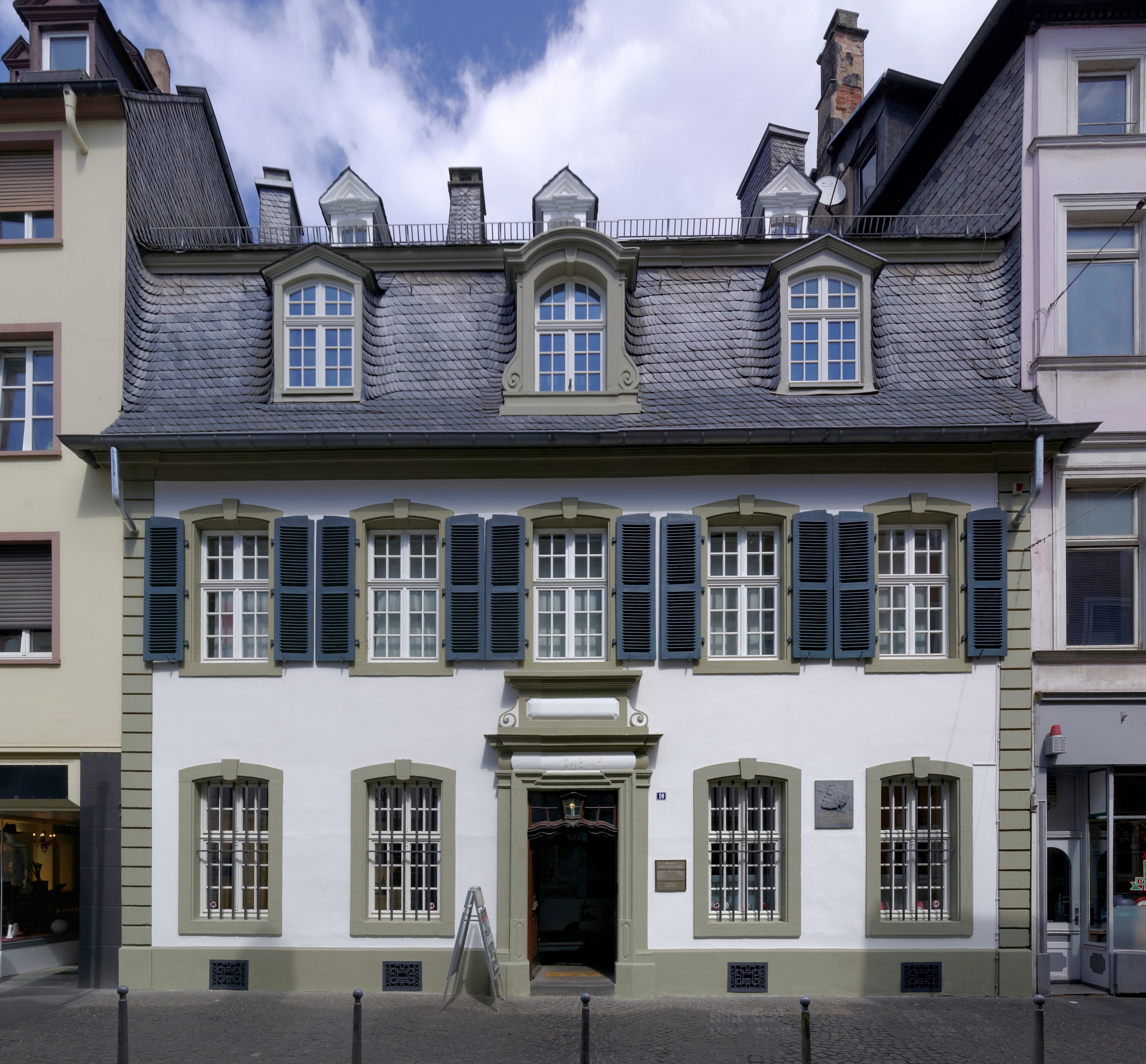
Trier, Brückenstraße 10; Karl Marx Geburtshaus; Karl-Marx-Museum; barockes Wohnhaus, sandsteingegliederter Mansarddachbau, 1727; Innenhof, hölzerner Laubengang, Renaissancebau mit Arkaden und Fachwerkobergeschoss, Garten mit alten Umfassungsmauern
English:
Karl Marx birthplace in Trier, Germany - Brückenstraße 10
|
| Date | |
| Source | Own work |
| Author | Berthold Werner |
| Other versions | http://www.bildindex.de/document/obj20747007?part=0&medium=mi13503f12 |
| Camera location |
|
View this and other nearby images on: OpenStreetMap |
|
|---|
Licensing
This file is licensed under the
Creative Commons
Attribution-Share Alike 3.0 Unported
license.
Attribution:
Berthold Werner
-
You are free:
- to share – to copy, distribute and transmit the work
- to remix – to adapt the work
-
Under the following conditions:
- attribution – You must give appropriate credit, provide a link to the license, and indicate if changes were made. You may do so in any reasonable manner, but not in any way that suggests the licensor endorses you or your use.
- share alike – If you remix, transform, or build upon the material, you must distribute your contributions under the same or compatible license as the original.

|
This image has been assessed under the valued image criteria and is considered the most valued image on Commons within the scope: Karl-Marx-Haus, facade . You can see its nomination here . |
|
|
This image has been assessed using the
Quality image guidelines
and is considered a
Quality image
.
|