USGS_geologic_map_Mali's_Birimian.png
Size of this preview:
798 × 599 pixels
.
Other resolutions:
320 × 240 pixels
|
639 × 480 pixels
|
1,023 × 768 pixels
|
1,048 × 787 pixels
.
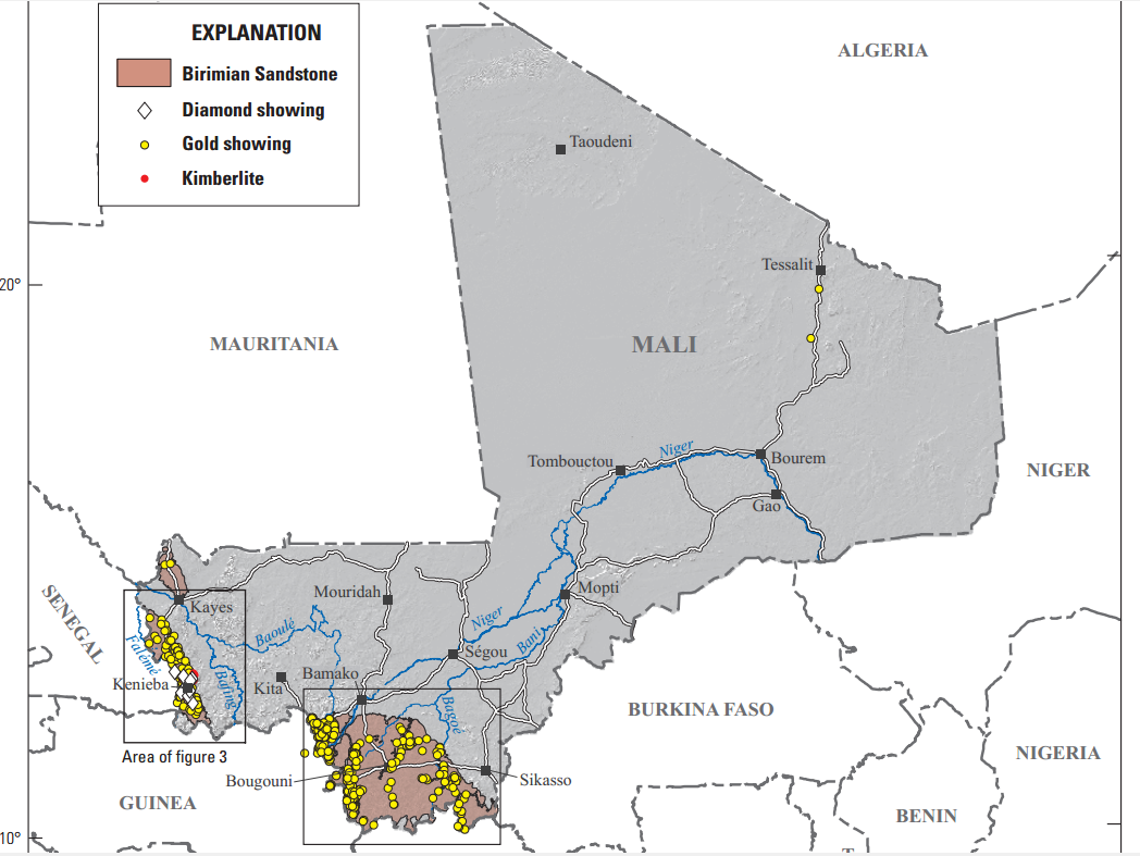
Summary
| Description |
English:
USGS geologic map Mali's Birimian
|
| Date | |
| Source | Alluvial Diamond Resource Potential and Production Capacity Assessment of Mali: U.S. Geological Survey Scientific Investigations Report 2010–5044, https://pubs.usgs.gov/sir/2010/5044/pdf/sir2010-5044.pdf |
| Author | Chirico, P.G., Barthélémy, Francis, and Koné, Fatiaga |
Licensing
|
|
This image is in the
public domain
in the United States because it only contains materials that originally came from the
United States Geological Survey
, an agency of the
United States Department of the Interior
. For more information, see
the official USGS copyright policy
.
|
|