WWtopo_shading.jpg
Size of this preview:
523 × 599 pixels
.
Other resolutions:
209 × 240 pixels
|
419 × 480 pixels
|
983 × 1,126 pixels
.
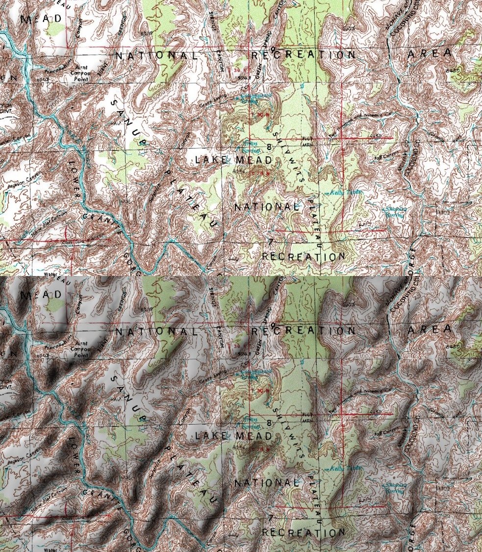
Topo map of Lake Mead areal - screenshot from World Wind showing the flat map (top) and the shaded version (bottom - with ligh source in the upper left corner)
|
|
This image is in the
public domain
because it is a screenshot from
NASA
’s globe software
World Wind
using a public domain layer, such as Blue Marble, MODIS, Landsat, SRTM, USGS or GLOBE.
|

|